Have any questions? Contact us!
Join our team!
Request a free quote or consultation

A measured building survey is a detailed, accurate representation of an existing building’s structure, layout, and features. It’s used to capture precise dimensions, including floor plans, elevations, and sections, typically through tools like laser scanning or total stations. These surveys are essential for architects, engineers, contractors, and facility managers who need reliable data to plan refurbishments, extensions, or maintenance. Whether you’re managing a heritage building or preparing for a full-scale renovation, having a current measured survey helps prevent costly mistakes and supports smooth project planning.
What Is a Measured Building Survey?
A measured building survey is a precise method of documenting a building’s dimensions and features to produce accurate, scaled drawings or digital models. Using laser scanners, total stations, and CAD tools, surveyors capture the internal and external layout, structure, and key architectural details. The result typically includes floor plans, elevations, and sections that reflect the building’s current condition essential for planning renovations, extensions, or ensuring regulatory compliance.
Why Measured Surveys Are Important
Measured surveys are important because they provide an accurate and reliable foundation for any kind of construction, renovation, or property-related decision-making. Without precise measurements and drawings, architects and engineers risk designing from incorrect assumptions, which can lead to costly errors, planning permission issues, or project delays.
A measured survey ensures that everyone involved from designers to contractors has a clear understanding of the existing space, reducing the chances of miscommunication or rework. It also helps avoid problems like over-ordering materials, poorly fitting structures, or clashes with building regulations. Simply put, having accurate data at the start helps projects run smoother, stay within budget, and meet legal and design requirements.
Powerkh: Precision BIM and Measured Survey Solutions for Construction

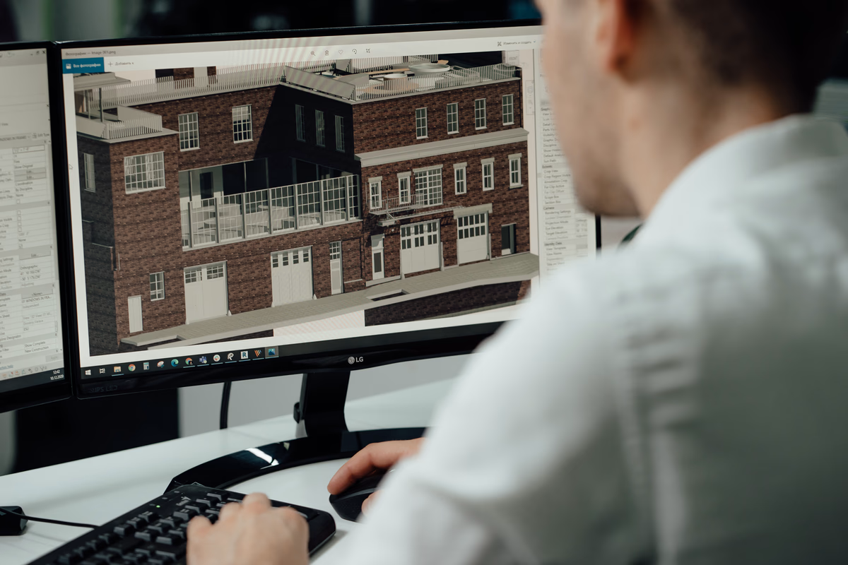
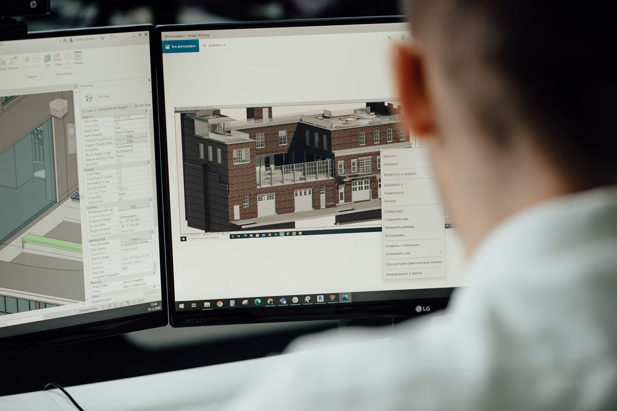
Powerkh specializes in measured building surveys and provides Building Information Modeling (BIM) and Virtual Design & Construction (VDC) services. We are a UK-based company with offices in Ukraine and the USA. Our work supports residential, commercial, and industrial projects at various stages, from early design to detailed coordination. We work with architects, engineers, contractors, surveyors, and on-site teams to deliver accurate digital models and practical construction data.
In our company, we handle BIM modeling across all levels of development (LOD 100-500), scan to BIM using point cloud data, BIM automation, and Revit content creation. We also provide prefabrication modeling for CNC workflows and detailed structural drawings for steel, rebar, precast, and facades. Many of our projects involve optimizing existing workflows and automating routine tasks to improve speed and consistency.
Our process is straightforward: define the scope, agree on deliverables, do the work, and provide support as needed. We use coordination tools for clash detection and track changes efficiently. We’ve built a workflow that adapts to shifting deadlines and changing requirements while staying focused on accuracy and delivery.
When Is a Measured Building Survey Needed?
A measured building survey is typically needed in the following situations:
- Planning an extension or renovation: Accurate drawings are essential to ensure new designs align with the existing structure.
- Property redevelopment or conversion: Before making major changes, a detailed survey helps assess what’s already in place.
- Preparing for architectural or interior design work: Designers use precise measurements to develop layouts, furniture placements, and structural alterations.
- Applying for planning permission: Local authorities often require scaled plans that accurately represent the existing building.
- Resolving boundary or party wall disputes: Measured surveys provide clear, legal documentation of building positions and dimensions.
- Facility management and maintenance planning: Accurate records help manage electrical systems, plumbing, HVAC, and emergency routes.
- Selling, leasing, or valuing a property: Buyers and valuers rely on up-to-date building data for negotiations and legal documents.
- Historic building documentation or preservation: Surveys are used to record and protect heritage properties before any intervention takes place.
Who Needs a Measured Building Survey?

Measured building surveys serve a broad range of professionals and property stakeholders who rely on accurate, up-to-date building data for decision-making, compliance, and planning. Here’s how different groups use these surveys in their work:
Architects and Designers
They use measured surveys as the foundation for design proposals, interior layouts, and renovation plans. Accurate base drawings ensure that all creative and technical decisions align with the real-world conditions of the building.
Engineers (Structural, Civil, MEP)
For engineers, precise building data is essential to assess feasibility, design support systems, and integrate new infrastructure. Whether it’s load-bearing analysis or routing of services, a measured survey provides the detail they need.
Construction Companies and Contractors
Contractors use survey data to align construction work with existing structures, reducing the risk of errors on-site. These surveys help coordinate trades, schedule tasks, and verify compliance during all stages of the build.
Property Developers
Developers rely on surveys to assess the potential of a site, prepare for planning applications, and understand the constraints or opportunities a building presents before starting redevelopment.
Facility and Property Managers
Accurate documentation supports maintenance planning, asset tracking, and systems management. It’s also helpful when coordinating upgrades or documenting the current state of a building for compliance.
Private Homeowners
Homeowners often commission measured surveys when planning extensions, major interior changes, or resolving property-related legal matters such as boundary disputes.
Real Estate Professionals and Valuers
Surveys provide the reliable square footage, layout, and structural detail needed for accurate property valuations, leasing documentation, or sales listings.
Lawyers and Legal Consultants
Legal professionals refer to measured survey data in cases involving property rights, lease agreements, rights of light, or ownership boundaries.
Public Sector and Local Authorities
These entities use detailed surveys for planning permissions, infrastructure projects, heritage building assessments, and zoning regulations.
What Does a Measured Survey Include?
The contents of a measured building survey may vary depending on the scope of the project, but it typically includes the following key deliverables:
- Floor Plans: Scaled drawings showing the layout of each building level, including walls, doors, windows, stairs, structural elements, and key fixtures. Can also include floor levels and finishes.
- Elevations: Scaled views of the building’s external and internal faces. These drawings include details such as door and window positions, finishes, materials, and architectural features.
- Sections: Cross-sectional views that illustrate the relationships between floors, ceiling heights, roof structures, and internal arrangements. Useful for analyzing vertical clearance and structural planning.
- Roof Plans: Detailed representation of the roof layout, showing slopes, ridges, valleys, drainage points, and access features – often used when planning extensions or rooflight installations.
- Reflected Ceiling Plans (RCPs): Diagrams showing ceiling features such as lighting, mechanical fixtures, soffits, and service routes – important for interior fit-outs and MEP coordination.
- Point Cloud Data: High-resolution 3D data captured through laser scanning. It serves as a precise digital record of existing conditions and is often used as the base for creating drawings or models.
- 3D Models: Optional deliverables built in CAD or BIM software (e.g. Revit, ArchiCAD, SketchUp). These models help teams visualise the space, plan interventions, and coordinate with engineers or consultants.
Technology Used in Measured Building Surveys
Modern measured building surveys rely on a combination of traditional tools and advanced digital technologies to capture highly accurate data. The choice of equipment depends on the project’s complexity, required precision, and site conditions.
Laser Scanners (3D Laser Scanning)
These devices emit laser beams to capture millions of spatial data points, creating a detailed point cloud – a digital representation of the building’s surfaces.
- Captures large areas quickly and accurately
- Ideal for complex geometries, high ceilings, or detailed façades
- Commonly used scanners: FARO, Leica, Trimble
Total Stations
A total station combines electronic distance measurement (EDM) and angle measurement. It is especially useful for capturing precise coordinates of specific building features.
- Accurate over long distances
- Ideal for setting out reference points or working in open areas
- Often used alongside 3D scanners
GPS and GNSS Equipment
While less common in confined building spaces, GPS tools can be used for exterior mapping and establishing georeferenced control points.
- Useful for integrating the survey with broader site plans
- Common in large infrastructure or land-based projects
Traditional Measuring Tools
In areas where scanners are impractical (tight corners, reflective surfaces, or very small details), surveyors may still use:
- Tape measures
- Laser distance meters
- Measuring wheels
- Spirit levels and plumb lines
Photography and Video Capture
Surveyors often take reference photos and 360° videos during the site visit to document existing conditions and support CAD or BIM drafting later.
Software for Data Processing
After collecting raw data, surveyors use specialized software to convert it into usable formats:
- AutoCAD – for 2D plans and technical drawings
- Revit – for 3D models and Building Information Modelling (BIM)
- SketchUp – for lightweight 3D visualisation
- Cyclone, Scene, or Recap – to process point clouds from laser scanners
The use of these technologies ensures that measured building surveys are not only highly accurate but also tailored to the specific needs of architects, engineers, and project managers.
Measured Survey Process: Step by Step

The process of a measured building survey is structured to ensure accuracy, consistency, and usability of the final data. Here’s a typical step-by-step breakdown:
1. Initial Consultation and Project Brief
The process begins with a discussion between the client and the survey team to define the project scope, objectives, and level of detail required. This stage covers the type of building, the specific deliverables needed, any access limitations, and the overall timeline and budget. It ensures that the survey is tailored to the exact needs of the project.
2. Site Visit and Data Capture
Once the brief is confirmed, surveyors visit the site to carry out the physical measurements. Advanced tools such as 3D laser scanners and total stations are used to capture accurate spatial data, while manual instruments may be employed in areas where technology is less effective. The team documents both the interior and exterior, records height levels, and captures visual references through photographs or video.
3. Data Processing and Point Cloud Generation
After the site visit, the collected raw data is processed using specialized software to generate a detailed point cloud. This 3D digital representation reflects the geometry and structure of the building with high accuracy. At this stage, the data is cleaned, aligned, and prepared for the production of technical drawings or models.
4. Drawing and Model Creation
Based on the processed data, the required drawings or 3D models are developed. These may include floor plans, elevations, cross-sections, roof plans, or full BIM models. Software such as AutoCAD, Revit, or SketchUp is commonly used, and the level of detail depends on the original brief – ranging from basic layouts to detailed architectural models.
5. Quality Assurance and Final Review
Before final delivery, all outputs are carefully checked for accuracy and consistency. This includes verifying that the drawings match the measured data, checking for any missing elements, and ensuring that the final work complies with scale and formatting standards. Any issues are resolved before the survey is finalized.
6. Delivery to Client
Final deliverables are sent in the agreed format usually as digital files (DWG, PDF, RVT, etc.) ready for use by architects, engineers, or planning consultants. Supporting documents such as scan reports or image files may also be included.
This structured workflow helps ensure that measured building surveys are reliable, clear, and tailored to meet each project’s unique requirements.
Common Problems Without a Measured Survey
Skipping a measured survey at the early stage of a project can lead to a range of avoidable issues affecting design accuracy, timelines, costs, and even legal compliance. Below are some of the most common problems that arise when reliable building data isn’t gathered in advance:
- Incorrect dimensions in design plans: Without accurate base drawings, architects and designers may rely on assumptions, leading to errors in layouts, room sizes, or structural alignment.
- Construction delays and cost overruns: Mistakes caused by inaccurate measurements often lead to rework, wasted materials, and unexpected site changes, increasing both time and budget.
- Planning permission issues: Submitting drawings that don’t accurately reflect the existing building can result in rejected applications or violations of planning regulations.
- Material waste and misordering: Over-or under-ordering materials due to poor measurements can result in increased costs and project inefficiencies.
- Legal disputes over boundaries or shared structures: Inaccurate data can complicate issues like party wall agreements, rights of light, or land ownership disputes.
- Design clashes during construction: Mismatched levels, misaligned windows, or structural conflicts may only become visible once work has started, causing costly changes on site.
- Poor integration of new systems: Inaccurate information can lead to complications when installing HVAC, electrical, or plumbing systems, especially in refurbishments.
- Unsatisfactory final results: A lack of reliable survey data may cause visual or functional discrepancies between the intended design and the finished build.
Conclusion
A measured building survey is a crucial step in the early stages of any construction, renovation, or property-related project. It provides precise, scaled information about a building’s existing layout, dimensions, and features, helping architects, engineers, contractors, and property owners avoid costly mistakes and delays. Whether you’re planning a home extension, managing a commercial redevelopment, or resolving legal boundaries, a professionally conducted measured survey ensures your plans are built on accurate and reliable data.
FAQ
What is a measured building survey?
A measured building survey is the process of accurately measuring and recording the physical structure of a building to produce detailed drawings or 3D models.
Who needs a measured survey?
Architects, engineers, contractors, developers, homeowners, legal professionals, and facility managers all benefit from measured surveys for planning, design, and compliance.
What does it include?
Typical outputs are floor plans, elevations, sections, roof plans, and 3D models. The level of detail depends on the project requirements.
What equipment is used?
Surveyors use tools like 3D laser scanners, total stations, GPS devices, and traditional tape measures, along with CAD or BIM software.
When should I get one?
Before starting any building work, including extensions, renovations, planning applications, or legal documentation such as party wall agreements or property sales.
How long does it take?
A simple survey may take a few hours on-site and a few days to process in the office. Larger or more detailed projects will require more time.
Our Case Studies
We have handled 200+ BIM & VDC projects for commercial, industrial, and residential sectors.
Our work includes:
Formwork design automation
Our client from
California, USA
Suspended ceiling design automation
Our client from
New York, USA
Wall framing design automation
Our client from
California, USA