Have any questions? Contact us!
Join our team!
Request a free quote or consultation

Imagine being able to capture every nook and cranny of a building, landscape, or object in a matter of minutes, turning it into a detailed 3D digital model. Sounds like sci-fi, right? Well, that’s exactly what a point cloud survey does! Using cutting-edge laser scanning technology, this method creates a “digital twin” of the real world, helping professionals in construction, engineering, and beyond work smarter and faster. Let’s break it down in a way that’s easy to grasp.
What is a Point Cloud Survey?
At its core, a point cloud survey is a way to collect super-accurate 3D data about an object or space. It uses a laser scanner to measure millions of points on surfaces, each with its own X, Y, and Z coordinates. These points come together to form a “point cloud”—a digital 3D map that looks like a starry sky of data. Think of it as a blueprint of reality, ready to be turned into detailed models or used for measurements.
How Does It Work?

Think of a laser scanner as a futuristic gadget straight out of a sci-fi movie, firing laser beams to map out the world in 3D. Instead of taking photos, it captures millions of precise measurements to create a digital replica of any space or object. Here’s a deeper dive into how this tech works its magic:
Emitting Laser Beams
The process kicks off with the scanner sending out rapid pulses of laser light. These beams zip through the air and bounce off surfaces—whether it’s a brick wall, a tree trunk, or a steel beam—and reflect back to the scanner’s sensor. This high-speed light show happens thousands or even millions of times per second, collecting a massive amount of data in a flash.
Measuring Time of Flight
Here’s where the science gets cool. The scanner measures the exact time it takes for each laser pulse to travel to a surface and return. Since light moves at a constant speed (about 300,000 kilometers per second), the scanner can calculate the precise distance to each point it hits. This “time of flight” method ensures measurements are accurate to within millimeters, even for faraway objects.
Creating the Point Cloud
As the laser beams bounce back, the scanner doesn’t just note the distance—it also tracks its own position and the angle of each beam. Using this info, it assigns X, Y, and Z coordinates to every point, building a 3D map called a point cloud. Picture a swarm of digital dots forming a detailed outline of the scanned area, like a constellation that mirrors reality. With modern scanners capturing up to a million points per second, the result is a super-dense, highly detailed 3D representation.
Scanning from Multiple Angles
Lasers travel in straight lines, so a single scan can’t capture everything, especially in complex spaces with corners, overhangs, or hidden nooks. To get the full picture, surveyors move the scanner to different spots, taking multiple scans from various angles. These scans are later stitched together using specialized software, ensuring every surface is mapped without gaps. It’s like piecing together a 3D puzzle of the real world.
Enhancing with Extra Data
To make the point cloud even more useful, surveyors can layer on additional data. For example, they might merge high-resolution photos to add color and texture, making the model look more lifelike. Or, they can tie the scan to geographic coordinates using GPS, which is handy for mapping large outdoor areas like construction sites or landscapes. These extras boost the point cloud’s accuracy and versatility for different projects.
The end result? A stunningly accurate 3D digital snapshot of the real world, ready to be transformed into models, measurements, or visualizations for all kinds of applications.
Powerkh: Pioneering Point Cloud to BIM Solutions

Powerkh is a UK-based company with additional offices in the USA and Ukraine. In our company, we provide BIM and VDC services for residential, commercial, and industrial construction projects. We have completed over 200 projects involving digital modeling, coordination, and construction documentation.
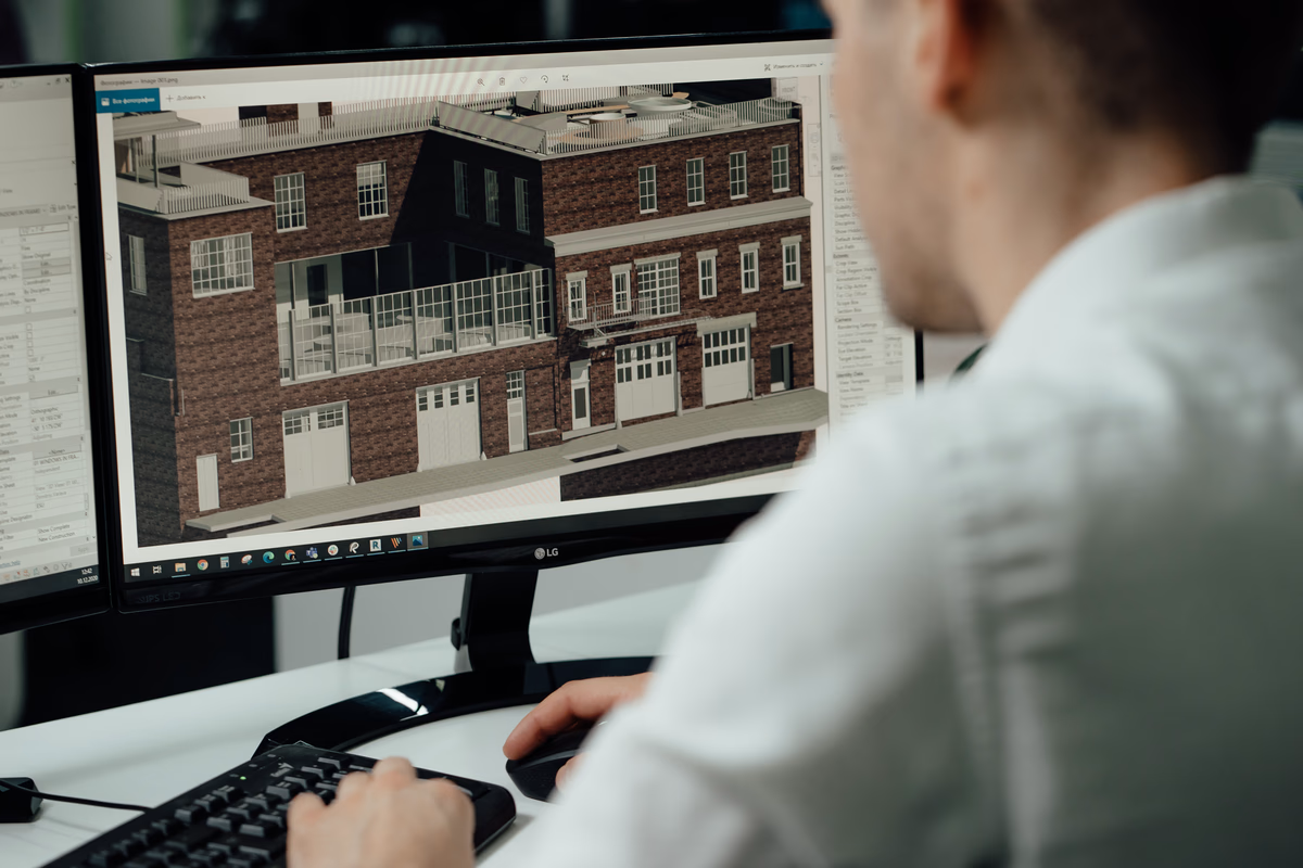
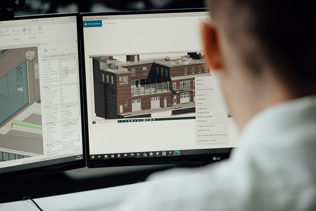
In our work, CAD to BIM conversion is a core service. We use Autodesk Revit to convert 2D CAD drawings into 3D BIM models, covering architectural, structural, and MEP elements. These models are developed to varying levels of detail, from LOD 100 to LOD 500. As part of the process, we run clash detection and prepare shop drawings when required.
Our team also handles scan to BIM using point cloud data, creates Revit families, develops automation scripts in tools like Dynamo, and produces structural detailing for prefabrication and fabrication. In our company, we support architects, engineers, contractors, and site teams with modeling and documentation needed at different stages of construction.
Key Highlights:
- UK-based company with offices in the USA and Ukraine
- Completed over 200 BIM and VDC projects
- Develops BIM models up to LOD 500 using Autodesk Revit
- Supports architectural, structural, and MEP modeling
- Provides clash detection and shop drawing production
- Works with point cloud data for scan to BIM
Services:
- CAD to BIM conversion
- BIM modeling (LOD 100 to LOD 500)
- BIM coordination and clash detection
- Revit family creation
- Scan to BIM
- BIM automation and scripting
- Structural detailing for prefabrication and fabrication
Why Are Point Cloud Surveys So Awesome?
So, why choose a point cloud survey over old-school measuring tapes or manual surveys? Here’s what makes them stand out:
- Crazy Accurate: With millimeter-level precision, you get measurements you can trust for even the most demanding projects.
- Lightning Fast: Scanners capture massive amounts of data in minutes, saving hours (or days) compared to traditional methods.
- Super Detailed: The point cloud gives you a rich, 3D view of every surface, perfect for visualizing complex spaces or spotting tiny details.
- Versatile Vibes: Use the data to build 3D models, run simulations, or double-check construction progress. It’s like a Swiss Army knife for spatial data.
- Fewer Do-Overs: Accurate scans mean fewer trips back to the site, cutting costs and keeping projects on track.
Where Are Point Cloud Surveys Used?

Point cloud surveys are like a superpower for professionals working with physical spaces, transforming how we plan, build, and preserve the world around us. Their ability to capture precise 3D data makes them invaluable across a wide range of fields. Let’s dive into the key areas where these surveys truly make a difference:
Construction and Architecture
In construction and architecture, point cloud surveys are a game-changer for both new builds and renovations. Before breaking ground, they provide a detailed 3D map of existing structures, creating accurate “as-built” records that serve as a foundation for planning. These surveys help architects and contractors spot potential design conflicts—like pipes or beams that might clash with new plans—before they become costly problems. They’re also essential for Building Information Modeling (BIM), where point clouds are used to craft detailed 3D models that guide every stage of a project, from design to completion. It’s like having a crystal ball that shows exactly what you’re working with.
Engineering
Engineers rely on point cloud surveys to tackle complex projects with precision. Whether it’s a sprawling factory, a towering bridge, or an intricate pipeline system, these surveys deliver a digital snapshot of facilities and structures down to the smallest detail. This data is critical for tasks like structural analysis, ensuring buildings or bridges can withstand stress over time. Point clouds also support asset management by providing a clear record of equipment and infrastructure, making maintenance and upgrades a breeze. With millimeter-level accuracy, engineers can work with confidence, knowing their plans are based on reality.
Land Surveying
When it comes to mapping the earth’s surface, point cloud surveys are a go-to tool for land surveyors. They make quick work of creating digital elevation models (DEMs) that show the ups and downs of a terrain, whether it’s a rugged hillside or a flat plot for a new highway. These surveys produce highly detailed topographic maps that are essential for planning roads, railways, or large infrastructure projects. The speed and accuracy of point clouds mean surveyors can cover vast areas without sacrificing precision, turning weeks of manual work into a few hours of scanning.
Specialized Applications
Beyond construction and engineering, point cloud surveys shine in some pretty unique fields. Archaeologists use them to digitally preserve ancient ruins, capturing every crack and carving before time or weather takes its toll. Forensic investigators rely on point clouds to map crime scenes or accident sites, creating 3D models that help piece together what happened with incredible accuracy. Historians and preservationists also turn to these surveys to archive heritage sites, ensuring culturally significant landmarks are documented for future generations. From uncovering the past to solving mysteries, point clouds are a versatile tool for capturing moments in time.
Conclusion
Point cloud surveys are like a superpower for anyone working with physical spaces. By using laser scanning to create detailed, accurate 3D models, they save time, boost precision, and open up endless possibilities for planning and analysis. Whether you’re building a skyscraper, mapping a forest, or preserving a piece of history, this technology makes the impossible feel totally doable. So, next time you hear “point cloud,” you’ll know it’s just a fancy way of turning the real world into a digital masterpiece!
FAQS
What exactly is a point cloud survey, and why is it useful?
A point cloud survey uses laser scanning technology to capture millions of 3D data points from surfaces, creating a digital “point cloud” that maps out a space or object with pinpoint accuracy. Think of it as a 3D blueprint of the real world! It’s super useful because it provides detailed, millimeter-precise models for things like construction planning, engineering analysis, or even preserving historical sites, saving time and reducing errors.
How long does it take to complete a point cloud survey?
The time depends on the size and complexity of the area being scanned, but point cloud surveys are way faster than traditional methods. A small building might take just a few hours, while a large site could take a day or two. The scanner captures up to a million points per second, so it’s incredibly efficient. Plus, the data can be processed quickly to create 3D models, speeding up project timelines.
Can point cloud surveys be used for outdoor and indoor spaces?
Absolutely! Point cloud surveys work like a charm for both. Outdoors, they’re great for mapping landscapes, roads, or large infrastructure projects, creating detailed topographic maps or elevation models. Indoors, they capture every corner of buildings, from quirky old structures to modern factories, making them perfect for renovations or facility management. The tech is versatile enough to handle almost any environment.
Do I need special software to use point cloud data?
You’ll need some specialized software to process and work with point cloud data, but it’s not as daunting as it sounds. Most point clouds are imported into tools like those used for Building Information Modeling (BIM) or other 3D modeling programs. These platforms let you analyze, visualize, or manipulate the data for your project. If you’re not tech-savvy, you can hire professionals to handle the calibration and modeling for you.
Our Case Studies
We have handled 200+ BIM & VDC projects for commercial, industrial, and residential sectors.
Our work includes:
Formwork design automation
Our client from
California, USA
Suspended ceiling design automation
Our client from
New York, USA
Wall framing design automation
Our client from
California, USA