Herhangi bir sorunuz var mı? Bize ulaşın!
Ekibimize katılın!
Ücretsiz fiyat teklifi veya danışmanlık talep edin

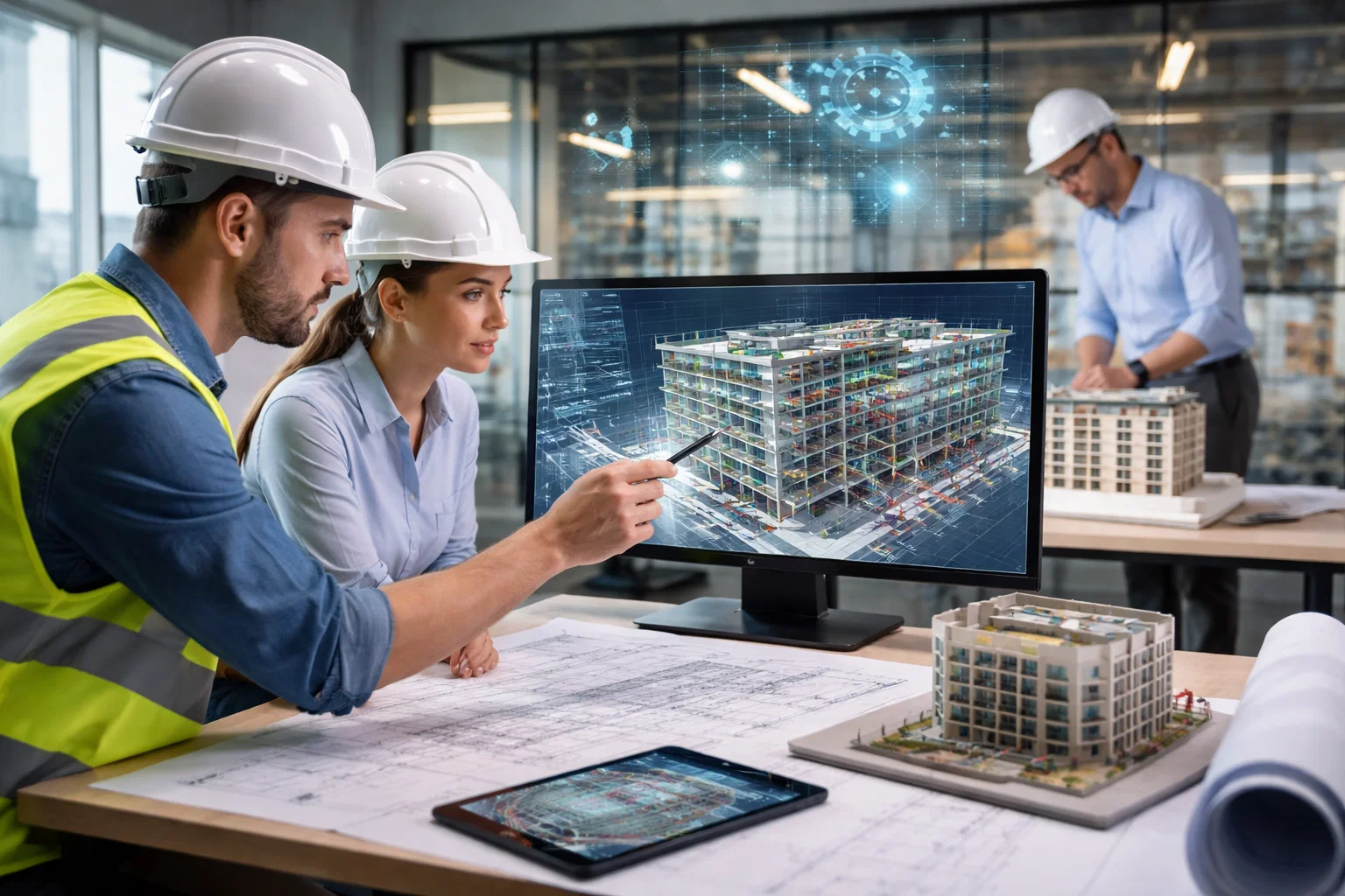
Laser scanning has changed how buildings get surveyed and documented in the UK. Instead of slow manual measurements that miss details or risk errors, teams now use high-precision 3D laser scanners to capture millions of data points in minutes. The result is a detailed point cloud-basically a digital twin of the structure – that architects, engineers, and contractors rely on for accurate as-built records, clash detection, refurbishments, or heritage preservation. It’s especially useful on tricky sites like historic properties or busy construction zones where traditional methods just don’t cut it anymore.
Several standout companies lead the field here, known for consistent quality, advanced tech, and nationwide reach. They handle everything from internal building scans and facade details to full-site captures, often turning raw scan data into usable BIM models, CAD drawings, or Revit families. Whether the job involves a London high-rise, an industrial facility up north, or a listed building in Scotland, these providers deliver reliable results with minimal disruption, helping projects stay on time and budget. Their experience covers commercial, residential, and infrastructure work, making them go-to options when precision really matters.
1. Powerkh

| Web sitesi: | www.powerkh.com |
| Telefon: | +447490426678 |
| E-posta: | [email protected] |
| Adres: | 3, Lavinia Walk, Taw Hill, Swindon SN25 1AP |
| LinkedIn: | www.linkedin.com/company/powerkh |
| Facebook: | www.facebook.com/Powerkh-100153471390616 |
| Instagram: | www.instagram.com/powerkh_com |
We are Powerkh, an engineering-led digital construction consultancy based in the UK. We support project teams from the early design phase all the way through to construction, with a real focus on keeping design intent intact no matter what pressures come up during coordination or on site. That means using BIM tools, engineering judgement, and reality-based verification to make sure nothing important gets lost or watered down as the project moves forward.
Laser scanning plays a key part in what we do, especially when it comes to capturing existing conditions accurately. We handle LiDAR scans for building surveys, point cloud surveys here in the UK, building deviation analysis straight from the laser scan data, and terrestrial laser scanning in general. It helps us create reliable as-builts, spot differences between plans and reality, and feed that precise info into BIM models or coordination work without guesswork.
Önemli Noktalar:
- Engineering-led focus
- Design continuity through all stages
- BIM and reality verification integration
- UK-based with practical project support
Hizmetlerimiz:
- Laser scan survey
- Point cloud survey service
- Building deviation analysis from laser scan
- Terrestrial laser scanning
2. Scantech International

| Web sitesi: | scantech-international.com |
| Telefon: | 01625 260446 |
| E-posta: | [email protected] |
| Adres: | Hillside, Murrayfield, Prestbury SK10 4BZ |
Scantech International focuses on 3D laser scanning for accurate as-built data in the built environment. The company has offered these services since 2002, making it one of the earlier players in the UK to adopt the technology. Projects cover sectors like nuclear, energy, process, water, buildings, and transport, with deliverables including topographic surveys, point clouds, elevations, sections, and panoramic images from scans.
Clients sometimes mention flexibility in approach and fewer site revisits thanks to the scanning process. Case studies include work on structures like Harringworth Viaduct for a long topographic and point cloud survey, Manchester Victoria Station ventilation upgrades using panoramic data, and other sites such as Twickenham Stadium or Kings College London. The emphasis stays on listening to project needs and delivering appropriate solutions without much fuss.
Önemli Noktalar:
- Operating from Macclesfield base
- Early adopter of 3D laser scanning in UK
- Range of sector experience including energy and transport
- Point cloud and topographic deliverables common
Hizmetlerimiz:
- 3D lazer tarama
- Engineering site surveys
- BIM-related work
- Topographic surveys
- As-built dokümantasyonu
3. Red Laser

| Web sitesi: | redlaser.co.uk |
| Telefon: | 0207 477 2175 |
| E-posta: | [email protected] |
| Adres: | 23 Sussex Street London, SW1V 4RR |
| LinkedIn: | www.linkedin.com/company/red-laser |
| Facebook: | www.facebook.com/Red-Laser-Scanning-182965455924026 |
| Instagram: | www.instagram.com/redlaserscanning |
Red Laser handles a mix of surveying and geospatial work, including laser scanning for precise 3D models of spaces. Measured building surveys produce detailed plans and architectural drawings, while laser scanning supports construction and renovation with high-accuracy point capture. Other areas include topographical mapping, utility detection, GPR for subsurface views, and BIM modeling to help manage projects digitally.
Equipment draws from brands like Leica and FARO depending on the job size or access issues, with scanners hitting up to a million points per second and accuracy around +/-1mm in some setups. The process usually involves an initial enquiry, scoping, on-site work, then processing and delivery in formats like AutoCAD or Revit. Sectors range from real estate and heritage buildings to healthcare, infrastructure, and public projects.
Önemli Noktalar:
- UK coverage with focus on London areas
- 24/7 availability for enquiries
- Transparent pricing approach mentioned
- Customised survey options
Hizmetlerimiz:
- Laser scanning survey
- Measured building survey
- Topographical survey
- Utility survey
- GPR survey
- BIM hizmetleri
4. TopoCrew

| Web sitesi: | www.topocrew.co.uk |
| Telefon: | 03301 337210 |
| E-posta: | [email protected] |
| Adres: | 171 Kingston Road, Teddington, TW11 9JP, UK |
| LinkedIn: | www.linkedin.com/company/topocrew |
TopoCrew carries out 3D laser scanning surveys mainly around London for construction, civil engineering, architectural, and infrastructure jobs. Scans deliver millimetre-level detail in point clouds, which turn into 2D and 3D CAD models, elevation drawings, or even VR setups for visualisation. The approach cuts down on site time compared to older methods, helps spot deformations or clashes, and works well in busy or hard-to-reach spots.
Fleet includes the NavVis MLX handheld scanner for interiors, corridors, or cluttered areas with live feedback during capture, plus the Leica Pegasus 2 car-mounted system for quicker coverage of streets, highways, or larger urban zones. Since starting in 2009, the company has worked across various London boroughs as an approved supplier for some councils and design firms.
Önemli Noktalar:
- Millimetre precision in scans
- London-focused but covers multiple boroughs
- Handheld and vehicle-mounted options
- Reduced rework through detailed data
Hizmetlerimiz:
- 3D laser scanning surveys
- Topoğrafik araştırmalar
- CAD and BIM modelling
- Point cloud analysis
- Yükseklik çizimleri
- Setting out work
5. 360HQ

| Web sitesi: | 360hq.co.uk |
| Telefon: | +44(0) 203 576 6025 |
| E-posta: | [email protected] |
| Adres: | Unit G12, Clerkenwell Workshops 27/31 Clerkenwell Close London EC1R 0AT |
| LinkedIn: | www.linkedin.com/company/threesixtygrouphq |
| Twitter: | x.com/ThreeSixty_HQ |
| Facebook: | www.facebook.com/ThreeSixtyGroupHQ |
| Instagram: | www.instagram.com/three_sixty_group |
360HQ provides 3D laser scanning that captures millions of data points quickly to build detailed point clouds of structures or sites in a single visit. The non-contact method avoids damage risks and works especially on complex shapes where manual measuring falls short. Point clouds integrate with design software for accurate work without guesswork or multiple trips.
Services extend UK-wide from offices in London, Newcastle, Nottingham, and Edinburgh, covering small businesses through to larger organisations. Laser scanning forms part of broader reality capture options, alongside things like 3D BIM modelling, drone surveying, and photogrammetry when projects call for it. Speed and reliability help cut costs by skipping traditional tools and overheads.
Önemli Noktalar:
- UK-wide reach with multiple office locations
- High point capture rate per second
- Non-destructive and non-intrusive process
- Useful for reverse engineering or inspection tasks
Hizmetlerimiz:
- 3D lazer tarama
- Point cloud generation
- Integration with BIM software
- Reality capture services
6. Site Engineering Surveys Ltd
| Web sitesi: | www.sesltd.uk.com |
| Telefon: | (020) 7538 0870 |
| E-posta: | [email protected] |
| Adres: | 16 Tiller Court Tiller Road London E14 8PX |
Site Engineering Surveys Ltd started offering High Definition Surveying back in 2004 when laser scanning demand began picking up in the UK. The company handles surveys of elevations, facades, topography, as-builts, and engineering structures with portable 3D laser scanners that work like standard surveying setups – over known points, with height measurements and orientation. Scans capture exposed surfaces remotely in minutes to build dense point clouds, and the scan rate hits around 50,000 points per second for quicker coverage and finer detail than manual methods.
Projects span innovative work across the UK, often feeding into design confidence by pulling more as-built info. Uses include planning stages, topographic surveys, detailed elevations, heritage buildings, measured building surveys, as-builts for construction, and volume calculations. The approach fits into broader land, building, and construction surveying without much extra fanfare.
Önemli Noktalar:
- Introduced HDS services in 2004
- Experienced with elevations and facades
- Portable scanner setups
- Dense point cloud output
Hizmetlerimiz:
- Lazer tarama
- Topoğrafik araştırmalar
- Bina araştırmaları
- As-built surveys
- Ölçülen bina etütleri
7. Cura Surveys

| Web sitesi: | curasurveys.co.uk |
| Telefon: | 020 3488 5858 |
| E-posta: | [email protected] |
| Adres: | 12 John Prince’s Street London W1G 0JR |
| LinkedIn: | www.linkedin.com/company/cura-surveys |
| Twitter: | x.com/CuraSurveys |
| Facebook: | www.facebook.com/people/Cura-Surveys/100063926742608 |
Cura Surveys uses 3D laser scanning to grab millions of data points for detailed representations of buildings and sites, often with Leica P40 scanners alongside RTK GPS or drone bits for tricky spots. The method stays non-contact and quick, producing point clouds that show intricate geometries hard to get manually. Point cloud data gets visualised in software for measurements, virtual checks, or integration elsewhere, and it proves handy for as-built records on renovations or maintenance.
BIM surveys build on that with digital models holding geometric and other data to aid collaboration, clash spotting, cost estimates, scheduling, facility management, and even energy analysis. The company focuses on complex or heritage projects like listed buildings, delivering things like BIM-ready models, CAD drawings, or planning docs. Coverage runs London and wider UK, with fast mobilisation options when deadlines press.
Önemli Noktalar:
- Millimetre-level accuracy focus
- In-house equipment use
- RICS-regulated practice
- Handles heritage and complex sites
Hizmetlerimiz:
- 3D lazer tarama
- BIM surveys
- Point cloud creation
- CAD drawings
- As-built dokümantasyonu
8. Apex Engineering Services
| Web sitesi: | apex.uk.net |
| Telefon: | +44 207018 1635 |
| E-posta: | [email protected] |
| Adres: | F7 Expressway, 1 Dock Road, London, E16 1AH |
| LinkedIn: | www.linkedin.com/company/aes_2 |
| Facebook: | www.facebook.com/APEX.Eng.Services |
| Instagram: | www.instagram.com/apex.engineering.services |
Apex Engineering Services applies terrestrial and UAV LiDAR for laser scanning to create high-definition 3D representations of structures, spaces, and landscapes. High-speed scanners capture millions of points fast, even in complex or tough environments, yielding point clouds and digital replicas on grids with tight tolerances like 5mm. Deliverables come in CAD-compatible formats, including maps, cross-sections, levels, and clearance details for full project support from planning through verification.
Leica TruView Enterprise comes as an add-on for cloud-based viewing of scans and point clouds – browser access for annotations, measurements, real-time sharing, and remote checks without special software. Projects have included utility tunnels with cable mapping or long infrastructure like tunnels before and after work. The setup suits detailed interrogation or collaboration across phases.
Önemli Noktalar:
- Terrestrial and UAV LiDAR options
- Point clouds on Ordnance Survey grid
- TruView for interactive viewing
- Cross-sections and long sections common
Hizmetlerimiz:
- Lazer tarama
- 3D modelleme
- Point cloud delivery
- CAD drawings
9. Cadplan Services Ltd

| Web sitesi: | cadplan.co.uk |
| Telefon: | 01732 469100 |
| E-posta: | [email protected] |
| Adres: | Cobtree House Oldbury Lane Ightham Kentb TN15 9DA |
| LinkedIn: | www.linkedin.com/company/cadplan-services-limited |
| Facebook: | www.facebook.com/Cadplan-Services-Limited-832283426908213 |
Cadplan Services Ltd carries out 3D laser scanning across the UK to produce fast, non-intrusive captures of buildings or sites, especially for refurbs, new developments, or as-built needs. Scanners pull millions of points quickly for comprehensive records that cut repeat visits and support planning. Outputs include 2D and 3D measurements like floor plans, elevations, sections, plus BIM-ready Revit models pulled straight from scan data for coordination in design teams.
The company adjusts approaches for different structures – historic ones to high-rises – and combines with topographic elements for fuller site views. Reports aim for clarity so contractors, consultants, or owners can use them easily. South London areas like Brixton, Croydon, and Clapham see a lot of their work, though jobs go nationwide in urban or rural spots.
Önemli Noktalar:
- UK-wide coverage
- Strong South London experience
- Revit model outputs
- Measured building survey background
Hizmetlerimiz:
- 3D lazer tarama
- Measured drawings
- Topographic survey integration
- BIM and Revit models
- Nokta bulutu verileri
10. Oxford Measured Survey

| Web sitesi: | oxfordmeasuredsurvey.co.uk |
| Telefon: | 0186 550 9099 |
| E-posta: | [email protected] |
| Adres: | 1 & 3 Kings Meadow, Osney Mead, Oxford, OX2 0DP |
| Facebook: | www.facebook.com/oxfordmeasuredsurvey |
Oxford Measured Survey carries out 3D laser scanning to gather precise data on buildings and sites for various uses. The company bases itself in Oxford and covers locations across the UK, using equipment from brands like Leica for scans that feed into point clouds processed with FARO Scene software. Deliverables usually include high-density point clouds, 2D plans with elevations and sections, plus 3D BIM models created in Revit for tracking building performance or design work.
Processes start with consultations to figure out project goals, move to site assessments for planning the scan approach, then data collection on-site, processing to build models and maps, and finally delivery of the outputs. Applications cover construction planning and monitoring, architecture for renovations or restorations, engineering analysis, heritage preservation of historical sites, and industrial asset management or maintenance. The method combines laser scanning with photogrammetry sometimes to add detail where needed.
Önemli Noktalar:
- Based in Oxford
- UK-wide coverage
- Leica and FARO tech mentioned
- Revit BIM models common
Hizmetlerimiz:
- 3D lazer tarama
- Point cloud surveys
- 2D plans and drawings
- 3D BIM modelling
- Ölçülen bina etütleri
11. PointSCAN

| Web sitesi: | www.pointscan.co.uk |
| Telefon: | +44 1767 661400 |
| E-posta: | [email protected] |
| Adres: | First Floor Suite 5&6, Shannon Court, 9 High St, Sandy SG19 1AG |
| LinkedIn: | www.linkedin.com/company/pointscan-limited |
| Twitter: | x.com/PointSCANLtd |
| Facebook: | www.facebook.com/PointSCANLimited |
| Instagram: | www.instagram.com/PointSCANLimited |
PointSCAN focuses on 3D laser scanning surveys that capture on-site measurements with millimetre precision for buildings, sites, or facilities. The company uses FARO Focus scanners to collect point cloud data alongside high-definition 3D imagery, then processes it into 2D drawings or BIM-compatible 3D models, including digital twins or fly-throughs. Coverage stretches across the UK and into Europe, with work in industrial, commercial, and residential settings since around 2016.
Different industries get tailored approaches – water and wastewater for plant facilities, engineering and construction for project delivery, heritage and restoration for detailed records, arboriculture perhaps for site-specific needs, buildings and architecture for design, or even film and media for virtual setups. The emphasis sits on accurate data transfer to CAD or BIM formats to support stakeholders like designers, engineers, or project managers in understanding environments quickly.
Önemli Noktalar:
- FARO Focus scanners used
- UK and Europe coverage
- Nokta bulutundan BIM'e dönüştürme
- Heritage and industrial experience
Hizmetlerimiz:
- 3D laser scanning surveys
- Nokta bulutu işleme
- 2D çizimler
- 3D CAD modelling
- BIM digital modelling
12. Multivista
| Web sitesi: | www.multivista.com |
| Telefon: | +44 2086 109 869 |
| E-posta: | [email protected] |
| LinkedIn: | www.linkedin.com/company/multivista |
| Twitter: | x.com/Multivista |
| Facebook: | www.facebook.com/Multivista |
| Instagram: | www.instagram.com/multivista |
Multivista provides 3D laser scanning as part of reality capture for the AEC sector, focusing on fast point cloud creation from as-built environments. Services include converting scans to BIM models or 2D plans, with use cases like renovation documentation, pre-slab and MEP checks, construction verification, floor flatness reports, or asset maintenance. The company operates in multiple markets with local experts available in various cities, though specific UK details stay limited in the main descriptions.
Point clouds form the core deliverable, often feeding into workflows for validating designs against real conditions or spotting issues early. The approach suits projects of different sizes where digitising existing structures helps avoid costly problems during planning or operations.
Önemli Noktalar:
- Scan to BIM and Scan to Plan options
- Point cloud focus
- Renovation and verification common
- Broad market presence
Hizmetlerimiz:
- 3D lazer tarama
- Point cloud capture
- Taramadan BIM'e dönüştürme
- 2D CAD plans
13. Addison Group
![]()
| Web sitesi: | addisongroup.uk |
| Telefon: | 01253 898 200 |
| E-posta: | [email protected] |
| Adres: | Unit 5b, Astra Centre, Harlow, Essex, CM20 2BN |
| LinkedIn: | www.linkedin.com/company/addisonproject |
| Twitter: | x.com/AddisonPlc |
Addison Group applies 3D laser scanning to record physical objects and structures into digital formats for remote analysis and measurements. The technology captures as-built or existing conditions from safe distances, generating point clouds that support plan views, sections, fly-throughs, or even overlaid meshes for reconstructions. Exports can go to Leica TruView for online access, letting third parties view, measure, and collaborate without dedicated software.
The method suits civil engineering, plant design, architecture, and construction where reducing return visits or accessing tough spots matters – like avoiding scaffolding. Point clouds enable better project management through review and sharing, with potential for lower costs in as-built drawings or surveys.
Önemli Noktalar:
- Leica TruView integration
- As-built capture focus
- Remote access options
- Engineering applications
Hizmetlerimiz:
- 3D lazer tarama
- Point cloud generation
- Plan and section views
- TruView exports
14. Hextra Surveying Limited

| Web sitesi: | hextrauk.com |
| Telefon: | +442085928585 |
| E-posta: | [email protected] |
| Adres: | Unit 3 Petronne House – 31 church street dagenham RM10 9UR |
Hextra Surveying Limited includes 3D laser scanning among its surveying options for accurate data collection on buildings and sites. The company operates from Dagenham in Essex and covers projects in the South-East, around the M25, and potentially further afield. Laser scanning fits into services like measured building surveys or topographical work where 2D or 3D data gets tied to Ordnance Survey grid or custom datums.
Modern equipment handles the capture for things like visualisation of complex structures or environments, often supporting design, analysis, and communication in construction or remodelling. The approach stays flexible with operatives available for day or night work depending on client schedules. P-Way surveying for rail sometimes overlaps, but building-related scans appear in their mix.
Önemli Noktalar:
- Based in Dagenham Essex
- Flexible day and night availability
- Ordnance Survey grid options
- Ties into measured building surveys
Hizmetlerimiz:
- 3D lazer tarama
- Ölçülen bina etütleri
- Topoğrafik araştırmalar
- GPS surveys
15. Baypoint Surveys
| Web sitesi: | www.baypoint.co.uk |
| Telefon: | 01202 301 012 |
| E-posta: | [email protected] |
| Adres: | 82 Castle Lane West, Bournemouth, BH9 3JU |
| LinkedIn: | www.linkedin.com/company/baypoint-surveys-limited |
| Instagram: | www.instagram.com/baypointsurveys |
Baypoint Surveys uses laser scanners for 3D scanning projects that need high accuracy on buildings or sites. The company tackles small-scale jobs through to more involved ones, producing outputs like internal floor plans, elevations, or classic 2D and 3D plans. Point cloud data often enhances BIM models for better integration in design workflows.
Other scans cover topographical work, quarry or historic site modelling, rail infrastructure, or monitoring over time. The process relies on the latest tech to grab detailed models quickly for analysis and planning. Bournemouth in Dorset serves as the base, with work spread across typical UK surveying scopes.
Önemli Noktalar:
- Handles small to complex projects
- BIM model enhancement via point clouds
- Historic site modelling included
- Rail infrastructure experience
Hizmetlerimiz:
- 3D lazer tarama
- Ölçülen bina etütleri
- Internal floor plans
- Yükseklikler
- Topoğrafik araştırmalar
- Monitoring surveys
16. Lincoln Conservation

| Web sitesi: | www.lincolnconservation.co.uk |
| Telefon: | 01522 835055 |
| E-posta: | [email protected] |
| Adres: | University of Lincoln Brayford Pool Lincoln Lincolnshire LN6 7TS United Kingdom |
| LinkedIn: | www.linkedin.com/company/lincoln-conservation |
| Instagram: | www.instagram.com/lincoln_conservation |
Lincoln Conservation creates 3D models of buildings and tall structures with laser scanners for heritage and conservation purposes. The digital records help understand historic fabric, track condition changes, or inform preservation decisions. Models also support public presentations by showing otherwise inaccessible areas.
Examples include work on Greyfriars in Lincoln for dimensionally correct elevation views, or Prendal Manor House in Nassington. The focus stays on accurate documentation that aids monitoring or restoration without physical interference. The approach suits listed or sensitive structures where detail matters for long-term care.
Önemli Noktalar:
- Heritage and conservation emphasis
- Condition monitoring capability
- Public presentation models
- Elevation views from scans
Hizmetlerimiz:
- 3D lazer tarama
- Building modelling
- Historic structure records
17. Digital Engineering Works Ltd

| Web sitesi: | deworks.uk |
| E-posta: | [email protected] |
| Adres: | Building 3, Clock Tower Park, Liverpool. L10 1LD |
| LinkedIn: | www.linkedin.com/company/deworks-uk |
| Twitter: | x.com/d_e_works |
Digital Engineering Works Ltd offers 3D laser scanning to build precise models of objects or environments, including buildings for reverse engineering or inspection. Scanners capture geometry quickly and non-invasively, suiting fragile or valuable structures without damage risk. Data feeds into CAD for design tweaks, new builds based on existing ones, or checks against tolerances.
Services extend to BIM, digital twins, reality capture, data management, asset handling, and visualisations. Reverse engineering focuses on creating digital building copies for improvements or adaptations. Inspection spots deviations for adjustments to meet standards, with other digital work like 3D printing rounding things out.
Önemli Noktalar:
- Non-invasive scanning method
- Reverse engineering for buildings
- Geometry inspection services
- Ties into BIM and digital twins
Hizmetlerimiz:
- 3D lazer tarama
- 3D modelleme
- Tersine mühendislik
- Inspection services
- BIM hizmetleri
Sonuç
Wrapping this up, laser scanning for buildings in the UK has quietly become one of those things you almost take for granted once you’ve seen it in action. What used to mean weeks of manual measuring and endless site visits now often boils down to a few hours with a scanner, followed by point clouds so detailed they reveal cracks, misalignments, or forgotten pipework nobody remembered. It’s changed how architects, engineers, and contractors approach everything from listed heritage work to shiny new commercial builds – less guesswork, fewer surprises when the walls actually go up.
The real shift isn’t just the tech itself, though the scanners keep getting faster and more portable every couple of years. It’s the way the data now flows straight into BIM models, clash detection runs, or deviation reports without losing fidelity along the way. If you’re working on anything where existing conditions matter – refurbishments, extensions, or simply needing rock-solid as-builts – laser scanning tends to pay for itself pretty quickly by cutting rework and keeping timelines realistic. Not every project needs it, sure, but when the geometry gets complicated or access is a headache, it’s hard to argue against spending a day scanning instead of a month arguing over measurements later.

Bir BIM Projeniz mi Var? Bizimle Konuşun.
Bize UlaşınVaka Çalışmalarımız
Ticari, endüstriyel ve konut sektörleri için 200'den fazla BIM ve VDC projesi gerçekleştirdik.
Çalışmalarımız şunları içermektedir:
Kalıp tasarım otomasyonu
Our client from
California, USA
Asma tavan tasarım otomasyonu
Our client from
New York, USA
Duvar çerçeveleme tasarım otomasyonu
Our client from
California, USA