هل لديك أي أسئلة؟ اتصل بنا!
انضم إلى فريقنا!
اطلب عرض أسعار أو استشارة مجانية

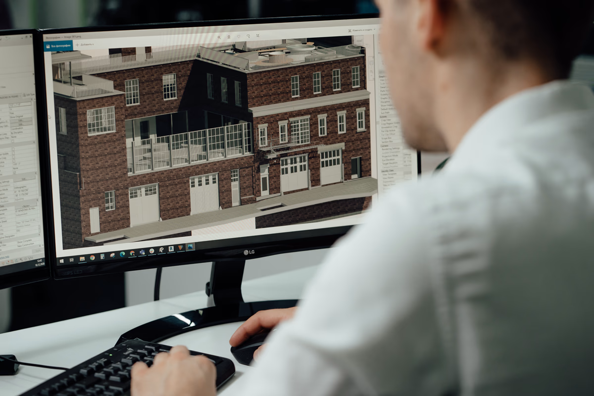
If you have ever stood on site staring at a laser scan and wondering how it turns into a clean Revit model, you are not alone. A point cloud looks impressive, but on its own it is just millions of dots. The real value comes when those dots are translated into something architects and engineers can actually work with.
Across the UK, there are companies that specialise in converting point cloud data into structured Revit models. Some focus on heritage buildings. Others handle large commercial sites or complex refurbishments. The challenge is not finding a provider. It is understanding what they really offer and which one fits your project.
1. باورخ

| الموقع الإلكتروني | www.powerkh.com |
| البريد الإلكتروني | [email protected] |
| فيسبوك | www.facebook.com/people/Powerkh/100064039650167 |
| لينكد إن | www.linkedin.com/company/powerkh |
| انستقرام | www.instagram.com/powerkh_com |
| العنوان | 3، لافينيا ووك، تاو هيل، سويندون SN25 1AP |
| الهاتف | +44 7490 426678 |
At Powerkh, we are a UK-based engineering-led digital construction consultancy. Our work covers design support, coordination, and construction-stage verification. As part of this, we provide point cloud to Revit services in the UK. We work with laser scan data and turn it into structured Revit models that teams can actually use.
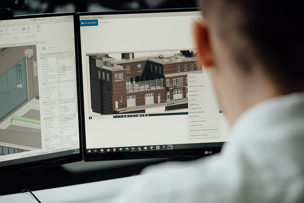
When we handle point cloud to Revit projects, we start with existing conditions. We process and validate point cloud data, align it with project coordinates, and model what is really there. That includes structure, MEP elements, and key architectural components. We do this so design decisions are based on verified information, not assumptions. Our focus is practical. The model must support coordination, design development, and later comparison with site conditions.
We stay involved beyond modelling. We support design continuity from early design through construction. That means we do not treat scan to Revit as a one-off task. We look at how the existing conditions model will feed into coordination, QA, and as-built verification. In UK projects, this often links to RIBA stages. We typically support teams from early design through technical design and into construction stage monitoring.
أبرز الملامح الرئيسية:
- UK-based engineering-led digital construction consultancy
- Provide point cloud to Revit UK services as part of scan to BIM workflow
- Process and validate laser scan data before modelling
- Revit modelling of existing conditions for design and coordination use
- Support across design and construction stages, not just modelling
الخدمات:
- Laser scanning and existing conditions modelling
- Point cloud processing and validation
- Revit modelling of existing buildings
- دعم التصميم الإنشائي والميكانيكي والكهربائي والسباكة
- BIM modelling and coordination readiness
- Design coordination and critical zone resolution
- Constructability and technical design review
- Deviation monitoring and design vs site comparison
- Evidence-based progress verification
- As-built verification and handover support
2. خدمات QeBIM

| الموقع الإلكتروني | www.qebimservices.co.uk |
| البريد الإلكتروني | [email protected] |
| فيسبوك | www.facebook.com/people/Qebim/100093318901204 |
| لينكد إن | www.linkedin.com/showcase/qebim |
| تويتر | x.com/qecad3d |
| العنوان | الطابق 5، ميدلسكس هاوس 29-45 هاي ستريت، إدجوير ميدلسكس HA8 7D |
| الهاتف | +44 74 8888 3489 |
QeBIM Services deal with laser scan data and turn it into Revit models that can actually support a project. Most of the work is around scanning to BIM and point cloud to Revit services in the UK, mainly for refurbishments and upgrades. Instead of handing over a heavy point cloud file and leaving it there, QeBIM rebuilds the space in Revit so the design team has something practical to work with.
The way it usually goes is this. Scan files arrive in standard formats. The data is cleaned up, aligned properly, and then the building is modelled inside Revit piece by piece. Structural elements, key architectural parts, services – all recreated based on the scan. Before delivery, the model is reviewed so it is coordinated and ready for design use.
Alongside point cloud to Revit modelling in the UK, QeBIM also supports coordination tasks like clash checks and BIM documentation. That becomes useful when existing buildings are being altered and there is not much room for guesswork. Take real-world scan data and turn it into a model that makes design and construction easier, not more complicated.
أبرز الملامح الرئيسية:
- Provide point cloud to Revit services in the UK
- Convert laser scan data into structured Revit models
- Support refurbishment and renovation projects
- Include clash detection as part of modelling workflow
- Work with multiple scan file formats
الخدمات:
- المسح الضوئي إلى خدمات BIM
- تحويل السحابة النقطية إلى نمذجة معلومات المباني
- Revit modelling from scans
- As-built BIM modelling
- اكتشاف التصادم
- Construction drawing services
- خدمات الرسم في المتجر
3. Tesla CAD UK Ltd

| الموقع الإلكتروني | www.teslacad.co.uk |
| البريد الإلكتروني | [email protected] |
| فيسبوك | www.facebook.com/teslacaduk |
| لينكد إن | www.linkedin.com/company/tesla-cad-uk |
| تويتر | x.com/teslacaduk |
| العنوان | Rear Of 17 Plantagenet Road, Barnet, UK, EN5 5JG |
| الهاتف | +44 333 011 9045 |
Tesla CAD UK Ltd handles point cloud to Revit projects across the UK, mainly for buildings that need renovation, retrofit, or detailed documentation. The company takes point cloud data and builds BIM models that represent the structure, architecture, and services of existing properties. These models are often used for refurbishment planning or long-term facility management.
The team works with different scan formats and develops models in Revit to match project requirements. Architectural details, structural components, and MEP systems are modelled from the scan data. In addition to point cloud to Revit in the UK, Tesla CAD UK Ltd also provides scan to CAD and scan to mesh, which can be useful when projects require 2D outputs or simplified geometry.
أبرز الملامح الرئيسية:
- Provide point cloud to Revit services in the UK
- Model architectural, structural, and MEP elements
- Support retrofit and redevelopment projects
- Work with multiple scan file types
- Offer scan to CAD and scan to mesh options
الخدمات:
- Point cloud to BIM modelling
- Architectural scan to BIM
- Structural modelling from scans
- MEP point cloud modelling
- تحويل المسح الضوئي إلى CAD
- Scan to mesh services
- الرسومات كما هي مبنية
4. Adaptive Surveys

| الموقع الإلكتروني | adaptivesurveys.co.uk |
| البريد الإلكتروني | [email protected] |
| فيسبوك | www.facebook.com/people/Adaptive-Surveys/61574606243818 |
| لينكد إن | www.linkedin.com/company/adaptive-surveys |
| انستقرام | www.instagram.com/adaptivesurveys |
| العنوان | 18 Abercrombie Court, Arnhall Business Park, Prospect Road, Westhill, Aberdeenshire, AB32 6FE |
| الهاتف | +44 (0)1224 460009 |
Adaptive Surveys start with the building itself. The team goes out to the site, sets up the scanners, and captures the space in detail. From that laser scan data, they create Revit models that reflect what is actually there, not what old drawings might suggest. It is a practical way of handling point cloud to Revit work in the UK, especially on projects where existing conditions cannot be guessed.
Once the point cloud is processed, the building is rebuilt inside Revit step by step. The level of detail depends on what the project calls for. Sometimes it is a straightforward layout model. Other times it goes deeper, with more defined elements for coordination or planning. Alongside point cloud to Revit services in the UK, Adaptive Surveys also carry out measured building surveys and produce terrain models, so the survey and BIM sides stay connected.
أبرز الملامح الرئيسية:
- UK survey specialists providing point cloud to Revit services
- Combine measured surveys with BIM modelling
- Deliver Revit models for planning and asset use
- Offer models at different levels of detail
- Provide additional survey outputs
الخدمات:
- Terrestrial laser scanning
- نمذجة Revit من السحب النقطية
- مسوحات المباني المقاسة
- Topographic surveys
- Digital surface and terrain models
- Orthomosaic image outputs
5. Conserve Engineering Solutions UK Ltd

| الموقع الإلكتروني | www.conservesolution.com |
| البريد الإلكتروني | [email protected] |
| فيسبوك | www.facebook.com/conservesolution |
| تويتر | x.com/conserve__soltn |
| لينكد إن | www.linkedin.com/company/conservesolutions |
| انستقرام | www.instagram.com/conserve_solutions |
| العنوان | 1 مان آيلاند، ريجوس، الطابق الثالث، ليفربول، إنجلترا، L3 1BP |
| الهاتف | +44 0786 7249154 |
Conserve Engineering Solutions UK Ltd provides scan to BIM and point cloud to Revit services within the UK. The company carries out on-site laser scanning and then processes that data into BIM models for engineering and construction teams. The focus is on documenting existing conditions and preparing reliable models before design or construction begins.
The workflow starts with digital surveys and scan registration. Once the point cloud is organised, it is converted into BIM-ready models. These models can then be used for coordination, engineering documentation, or as-built checks. Conserve also works with CAD and GIS platforms where needed, depending on project scope.
أبرز الملامح الرئيسية:
- Provide point cloud to Revit services in the UK
- Carry out on-site 3D laser scanning
- Convert scan data into BIM models
- Support engineering documentation
- Integrate data with CAD and GIS systems
الخدمات:
- المسح بالليزر ثلاثي الأبعاد
- التحويل من المسح الضوئي إلى BIM
- معالجة السحابة النقطية
- BIM modelling from scans
- Engineering documentation support
- Design vs as-built comparison
6. GlobalCAD Consultants Ltd

| الموقع الإلكتروني | globalcad.co.uk |
| البريد الإلكتروني | [email protected] |
| تويتر | x.com/globalcad |
| لينكد إن | www.linkedin.com/company/globalcad |
| انستقرام | www.instagram.com/globalcadbim |
| العنوان | المكتب رقم 9، دالتون هاوس، 60 شارع ويندسور، لندن، SW19 2R |
| الهاتف | +44 1252 975440 |
GlobalCAD Consultants Ltd works with point cloud data and turns it into Revit models for projects across the UK. A lot of the time, this is for refurbishments or buildings that are being updated, where knowing what is already there really matters. Instead of leaving teams with a heavy scan file, GlobalCAD rebuilds the building inside Revit so it can actually be used for design and planning.
The job normally starts with a look at the scan data and a quick check on what needs to be delivered. After that, the model is built up in Revit, covering architectural parts, structure, and MEP if the project requires it. The models follow UK BIM standards and can be used at different stages, whether that is early design, coordination during construction, or ongoing facilities work. It is a straightforward setup – take real-world scan data and turn it into something the project team can rely on.
أبرز الملامح الرئيسية:
- UK-based BIM consultancy
- Provide point cloud to Revit services
- Develop Revit models from 3D survey data
- Support refurbishment and asset management projects
- Follow UK BIM standards
الخدمات:
- Scan to BIM modelling
- Point cloud to Revit models
- النماذج كما هي مبنية ونماذج السجلات
- إنتاج الرسم ثنائي الأبعاد
- Asset tagging
- إسقاط بيانات BIM
7. Plowman Craven

| الموقع الإلكتروني | plowmancraven.com |
| البريد الإلكتروني | [email protected] |
| لينكد إن | www.linkedin.com/company/plowman-craven |
| العنوان | 2 Lea Business Park, Lower Luton Road, Harpenden, Hertfordshire, AL5 5EQ |
| الهاتف | 01582 765566 |
Plowman Craven operates in the UK and also works on projects overseas. The company sits somewhere between traditional surveying and digital construction. Day to day, the work covers measured surveys, inspection, asset management, and BIM support across different sectors. When it comes to point cloud to Revit services in the UK, Plowman Craven use laser scanning and geospatial tools to capture buildings and sites. That scan data is then developed into BIM models that teams can actually use for design and coordination. A lot of the projects involve complex environments – commercial buildings, infrastructure, heritage sites, or areas with limited access. Capture what is there, model it clearly, and give project teams reliable information to work from.
أبرز الملامح الرئيسية:
- Provide point cloud to Revit services in the UK
- Combine geospatial surveys with digital construction workflows
- Work across commercial, infrastructure, and heritage sectors
- Support asset management and inspection services
- Operate internationally with UK base
الخدمات:
- Measured surveys
- المسح بالليزر ثلاثي الأبعاد
- Digital construction support
- نمذجة BIM
- Asset management services
- Inspection and monitoring services
8. Datum Site Engineering Services

| الموقع الإلكتروني | www.datumsiteservices.co.uk |
| البريد الإلكتروني | [email protected] |
| العنوان | 6 Dovecote Drive, Haydock, St. Helen’s, Merseyside, WA11 0SD |
| الهاتف | 0800 7720495 |
Datum Site Engineering Services operate mainly in London and the south-east. The company provides scan to Revit and 2D Revit drawing services based on 3D laser scanning. Point cloud to Revit work in the UK forms a core part of their offering, especially for architects, surveyors, and structural engineers.
Datum attend site, carry out 3D laser scanning, and then convert the point cloud data into detailed Revit models or 2D drawings. The output supports planning, design, and construction stages. Alongside scan to Revit, Datum also provides topographic surveys, utility surveys, and measured building surveys, which often connect directly to BIM modelling projects.
أبرز الملامح الرئيسية:
- Provide point cloud to Revit services in London and the south-east
- Use 3D laser scanning to generate scan data
- Deliver Revit models and 2D drawings
- Work with architects and engineers
- Offer wider site engineering services
الخدمات:
- المسح الضوئي إلى Revit
- المسح بالليزر ثلاثي الأبعاد
- مسوحات المباني المقاسة
- Topographic land surveys
- Utility surveying
- Site engineering services
9. Survey Operations

| الموقع الإلكتروني | www.survops.co.uk |
| البريد الإلكتروني | [email protected] |
| تويتر | x.com/SurveyOps |
| انستقرام | www.instagram.com/surveyoperationsltd |
| العنوان | Smith Street, Skelmersdale, Lancashire, WN8 8LN |
| الهاتف | 01695 725662 |
Survey Operations provide surveying services across the UK, including Revit model production from point cloud data. The company converts laser scan information into detailed Revit models that can be used for renovation, infrastructure upgrades, and heritage projects. Point cloud to Revit services in the UK form part of their wider point cloud survey offering.
Laser scanning is carried out on site, and the collected data is processed into BIM-compatible models. These models help reduce the need for repeat visits and manual measurements. Survey Operations also work across architecture, civil engineering, and facilities management, where accurate digital representation of existing structures is required.
أبرز الملامح الرئيسية:
- Provide point cloud to Revit services in the UK
- Convert laser scan data into Revit models
- Support renovation and infrastructure projects
- Work in heritage and conservation sectors
- Offer a full range of surveying services
الخدمات:
- المسح بالليزر ثلاثي الأبعاد
- Revit model production
- Point cloud surveys
- Measured surveys
- Utility surveys
- Mapping services
10. Scene3D
| الموقع الإلكتروني | scene3d.co.uk |
| البريد الإلكتروني | [email protected] |
| فيسبوك | www.facebook.com/scene3d |
| لينكد إن | www.linkedin.com/company/scene3d |
| انستقرام | www.instagram.com/scene3d.co.uk |
| العنوان | Studio 03, SUM Studios, 1 Hartley Street, Sheffield, S2 3AQ |
| الهاتف | 0114 399 1023 |
Scene3D provides scan to Revit services in the UK, focusing on measured surveys and BIM-ready models. The company carries out point cloud surveys and converts the data into Revit files that include architectural, structural, and services elements. This helps project teams working on refurbishment and coordination projects where reliable existing data is needed.
The process usually starts with a site scan using laser scanners. The point cloud is then processed and modelled in Revit to match the required level of detail. Scene3D delivers models in native Revit format, with other exports available if required. The service is aimed at supporting planning applications, renovation design, and construction coordination.
أبرز الملامح الرئيسية:
- Provide point cloud to Revit services across the UK
- Carry out on-site laser scanning
- Deliver BIM-ready Revit models
- Support refurbishment and coordination projects
- Provide models aligned to project requirements
الخدمات:
- المسح الضوئي إلى BIM
- Point cloud surveys
- Revit modelling
- Measured surveys
- BIM-ready model delivery
- CAD and IFC exports
11. SolidPoint

| الموقع الإلكتروني | solidpoint.co.uk |
| البريد الإلكتروني | [email protected] |
| فيسبوك | www.facebook.com/SolidPoint.Surveyors |
| انستقرام | www.instagram.com/solidpoint_surveying |
| العنوان | 2, Wentworth House, Vernon St, Derby DE1 1UR |
| الهاتف | 01332 898350 |
SolidPoint operates across the UK providing measured surveys and BIM-ready outputs. The company carries out 3D laser scanning and converts point cloud data into Revit models as part of their scan to BIM workflow. Point cloud to Revit services in the UK are integrated with measured building surveys and land surveys.
The process begins with laser scanning to capture existing conditions. The point cloud data is then reverse engineered into intelligent 3D models inside Revit. SolidPoint delivers both 2D drawings and 3D BIM models, which support refurbishment, development planning, and space redesign projects. Survey outputs are tailored depending on project needs.
أبرز الملامح الرئيسية:
- Provide point cloud to Revit services in the UK
- Combine measured surveys with BIM modelling
- Deliver 2D drawings and 3D Revit models
- Use 3D laser scanning and drone surveys
- Support development and refurbishment projects
الخدمات:
- المسح بالليزر ثلاثي الأبعاد
- مسوحات المباني المقاسة
- المسوحات الطوبوغرافية
- Revit modelling services
- المسح الضوئي إلى BIM
- Drone surveys
- Utility and CCTV surveys
12. DDC Solutions

| الموقع الإلكتروني | ddcsolutions.co.uk |
| البريد الإلكتروني | [email protected] |
| فيسبوك | www.facebook.com/DDCSolutionsUK |
| تويتر | x.com/DDC_Solutions |
| لينكد إن | www.linkedin.com/company/ddcsolutions |
| انستقرام | www.instagram.com/ddc_solutions |
| العنوان | 86 – 90 Paul Street, London EC2A 4NE UK |
| الهاتف | 0208 058 5031 |
DDC Solutions deals with scanning data and turning it into proper Revit models for projects around the UK. A lot of jobs start with a point cloud, but that file on its own is not very helpful for a design team. DDC takes that data and rebuilds the building inside Revit so it can actually be used for coordination and planning.
Walls, floors, structure, and services are modelled based on what the scan shows. If MEP coordination is part of the brief, those systems are included as well. Alongside point cloud to Revit services in the UK, DDC also creates CAD drawings and construction information taken directly from the scanned environment. It is mainly for projects where teams need a clear picture of existing conditions before they start changing anything.
أبرز الملامح الرئيسية:
- Provide point cloud to Revit services in the UK
- Convert scan data into architectural, structural, and MEP models
- Support clash detection and coordination workflows
- Produce construction drawings from scan data
- Work with multidisciplinary teams
الخدمات:
- Point cloud to Revit
- المسح الضوئي إلى BIM
- Point cloud to 3D modelling
- Point cloud to MEP BIM modelling
- المسح الضوئي إلى CAD
- إنتاج الرسم الإنشائي
- Revit modelling services
13. Red Laser

| الموقع الإلكتروني | redlaser.co.uk |
| البريد الإلكتروني | [email protected] |
| فيسبوك | www.facebook.com/redlaserscanning |
| لينكد إن | www.linkedin.com/company/red-laser |
| انستقرام | www.instagram.com/redlaserscanning |
| العنوان | 23 Sussex Street London, SW1V 4RR |
| الهاتف | 0207 477 2175 |
Red Laser takes a practical approach to BIM work in the UK, including point cloud to Revit modelling. The process usually starts on site with laser scanning. Once the data is captured, it is processed and rebuilt inside Revit so the project team has a clear digital version of the space.
The company also deals with underground utility surveys and brings that information into the BIM environment. That means above-ground and below-ground elements can sit in the same coordinated model.
أبرز الملامح الرئيسية:
- Provide point cloud to Revit services in the UK
- Combine laser scanning with BIM modelling
- Support architectural, MEP, and underground projects
- Deliver models for coordination and planning
- Work across construction and engineering sectors
الخدمات:
- Architectural scan to BIM
- MEP scan to BIM
- Underground utility BIM services
- المسح بالليزر ثلاثي الأبعاد
- تحويل نموذج ثنائي الأبعاد إلى ثلاثي الأبعاد
- دعم اكتشاف التصادم
14. Terrain Surveys

| الموقع الإلكتروني | terrainsurveys.co.uk |
| البريد الإلكتروني | [email protected] |
| لينكد إن | www.linkedin.com/company/terrain-surveys-ltd |
| انستقرام | www.instagram.com/terrainsurveys |
| العنوان | Bridge Chambers, 28a High Street, Welwyn, Hertfordshire, AL6 9EQ |
| الهاتف | +44(0)143 884 1300 |
Terrain Surveys provide scan to BIM and point cloud to Revit services across the UK. The company carries out 3D laser scanning on site and converts point cloud data into Revit or IFC models. These models are used by architects, engineers, and contractors for design, coordination, and refurbishment projects.
The workflow covers project planning, scanning, registration of scans, and model creation. Registered point clouds are processed and then turned into intelligent BIM models. Terrain Surveys also deliver 2D plans, sections, and terrain models based on the same scan data. The service supports both building and site level projects.
أبرز الملامح الرئيسية:
- Provide point cloud to Revit services in the UK
- Carry out 3D laser scanning surveys
- Convert registered point clouds into BIM models
- Deliver Revit and IFC outputs
- Support commercial, residential, and heritage sectors
الخدمات:
- المسح بالليزر ثلاثي الأبعاد
- المسح الضوئي إلى BIM
- Revit model production
- Registered point cloud delivery
- 2D plans and elevations
- Digital terrain models
- المسوحات الطوبوغرافية
15. Sky Scan Surveys
| الموقع الإلكتروني | skyscansurveys.co.uk |
| البريد الإلكتروني | [email protected] |
| فيسبوك | www.facebook.com/SkyScanSurvey |
| تويتر | x.com/SkyScanSurveys |
| لينكد إن | www.linkedin.com/company/skyscansurveys |
| انستقرام | www.instagram.com/skyscansurvey |
| الهاتف | 07518511623 |
Sky Scan Surveys provide point cloud to Revit services in the UK through their scan to BIM workflow. The company captures buildings and sites using terrestrial laser scanning and drone photogrammetry. The collected data is then converted into Revit or IFC models at agreed LOD levels. The process covers capture, modelling, and delivery in one workflow.
Sky Scan Surveys define tolerances at the start of each project. Interiors, façades, roofs, and topographic areas are handled using different capture methods depending on site conditions. Models are delivered in coordinate systems such as OSGB36 or BNG, based on project needs. The company also provides registered point clouds, CAD drawings, and QA documentation alongside the BIM model. The focus is on clear scope, defined LOD, and verified outputs.
أبرز الملامح الرئيسية:
- Provide point cloud to Revit services in the UK
- Use terrestrial laser scanning and drone photogrammetry
- Deliver Revit and IFC models at agreed LOD levels
- Define tolerances and coordinate systems at project start
- Supply QA documentation with model delivery
الخدمات:
- المسح الضوئي إلى BIM
- Point cloud to Revit modelling
- IFC model production
- المسح بالليزر ثلاثي الأبعاد
- Drone roof inspections
- Topographic surveys
- إنتاج الرسم باستخدام التصميم بمساعدة الحاسوب (CAD)
- Registered point cloud delivery
الخاتمة
Picking a point cloud to Revit company in the UK is not only about speed. Fast delivery sounds good, but that is rarely the thing that saves a project. What matters more is how the scope is agreed, how the scan data is checked, and whether the finished model actually fits the way the team plans to use it.
Some companies are mainly survey-led. Others lean more towards modelling and coordination. A few try to handle both capture and QA as part of one process. You usually notice the difference later, when coordination meetings start and small modelling gaps suddenly become real issues on site.
Before making a decision, it helps to slow down and ask basic questions. What level of detail is really needed. What tolerances are acceptable. Which coordinate system will the model sit in. And what files will be delivered at the end. These are not complicated questions, but skipping them often leads to extra work later.
At its core, point cloud to Revit work is about turning scanned reality into something practical. Not just a neat-looking model, but one that reflects what is actually built. When that link between site and model is solid, the rest of the project usually feels a lot less stressful.

دراسات الحالة لدينا
لقد تعاملنا مع أكثر من 200 مشروع من مشاريع نمذجة معلومات المباني ونمذجة معلومات المباني للقطاعات التجارية والصناعية والسكنية.
يشمل عملنا ما يلي:
أتمتة تصميم القوالب
Our client from
California, USA
أتمتة تصميم السقف المعلق
Our client from
New York, USA
أتمتة تصميم إطارات الحائط
Our client from
California, USA