هل لديك أي أسئلة؟ اتصل بنا!
انضم إلى فريقنا!
اطلب عرض أسعار أو استشارة مجانية

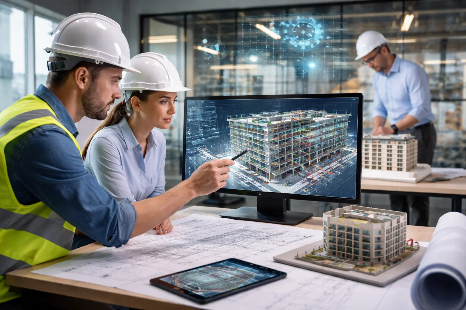
Reality capture services are revolutionizing how industries collect, analyze, and interpret spatial data. Whether you’re in construction, architecture, or urban planning, these services provide an incredibly detailed and accurate representation of the physical world. By using cutting-edge technology like 3D laser scanning, photogrammetry, and drone surveys, reality capture companies create digital models that simplify complex tasks, making decision-making faster and more informed.
In the UK, reality capture services are becoming indispensable for businesses seeking to streamline their operations and improve the accuracy of their projects. Companies offering these services use advanced equipment to capture precise measurements and generate 3D models of existing conditions. This level of detail is invaluable, especially when it comes to renovating buildings, creating topographic maps, or ensuring the precision of new infrastructure. If you’re looking to enhance your project’s accuracy, exploring top-tier reality capture companies in the UK could be a game-changer.
1. باورخ
| الموقع الإلكتروني | www.powerkh.com |
| البريد الإلكتروني | [email protected] |
| فيسبوك | www.facebook.com/people/Powerkh/100064039650167 |
| لينكد إن | www.linkedin.com/company/powerkh |
| انستقرام | www.instagram.com/powerkh_com |
| العنوان | 3، لافينيا ووك، تاو هيل، سويندون SN25 1AP |
| الهاتف | +44 7490 426678 |
At Powerkh, we integrate reality capture services with our core focus on maintaining design continuity throughout the construction process. Using advanced laser scanning and point cloud technology, we accurately capture and model existing site conditions, providing a reliable foundation for all design and coordination work. This reality-based verification process ensures that what is designed is what gets built, reducing discrepancies between design intent and the final structure. Our services help prevent errors and streamline project workflows, especially in complex or time-sensitive projects.
We utilize cutting-edge digital tools like BIM (Building Information Modeling) to process scanned data, ensuring that both existing conditions and design plans are aligned. By incorporating this data early on, we can identify potential issues before they become costly on-site problems. Whether it’s during the design or construction phase, we provide verification and support through each stage, ultimately ensuring a smoother handover with fewer disputes and greater project accuracy.
We work closely with design teams to ensure that structural and MEP (Mechanical, Electrical, Plumbing) systems are well-coordinated, while also focusing on resolving critical zone issues before construction begins. With our detailed as-built verification and handover support, we provide clear, objective information for a smooth project close-out, reducing the risk of disputes and ensuring that all design intent is delivered as planned.
أبرز الملامح الرئيسية:
- Expertise in BIM modeling and coordination
- Reality-based verification through laser scanning and point cloud processing
- Close collaboration with design and construction teams
- Independent progress verification and as-built model support
- Engineering-led approach to deviation monitoring and site coordination
الخدمات:
- Laser scanning and point cloud processing
- التحقق كما تم بناؤه
- تنسيق التصميم
- Deviation monitoring and site verification
- Construction support by providing evidence-based progress tracking for smooth execution
2. ScanTech Digital
| الموقع الإلكتروني | www.scantechdigital.com |
| البريد الإلكتروني | [email protected] |
| تويتر | x.com/ScanTechDigital |
| لينكد إن | www.linkedin.com/company/scantech-digital |
| انستقرام | www.instagram.com/scantechdigital |
| العنوان | 321 شارع برادفورد، ديجبيث، برمنجهام، B5 6ET |
| الهاتف | 0333 577 5752 |
ScanTech Digital is a UK-based company specializing in reality capture services and digital twin solutions. With a presence across the entire UK, they focus on providing accurate and accessible digital representations of physical assets. Their services span various industries, offering everything from 360° virtual tours to detailed point cloud surveys and 3D modeling. The company’s mission is to make the processes of design, construction, and operation more efficient by using the latest technology to capture and digitize existing conditions, ensuring a seamless transition from concept to execution.
Through their innovative approach, ScanTech Digital aims to add value by delivering clear, usable outputs that save both time and money. Their technology-driven solutions not only enhance the coordination of complex projects but also ensure that clients receive reliable and actionable data. Whether capturing assets with high-density laser scanning or providing aerial surveys with drones, ScanTech Digital’s services help clients manage their projects effectively from the planning stage through to operation.
أبرز الملامح الرئيسية:
- Specializes in reality capture and digital twin solutions
- Offers a wide range of services from 3D scanning to virtual tours
- Works across various industries including architecture, construction, and heritage
- Provides tailored services to meet the unique needs of each client
الخدمات:
- المسح الضوئي بالليزر
- المسح الضوئي إلى BIM
- Model Validation with AI-powered classification technology
- Aerial Surveys (Drone Surveys)
- Topographical and Area Measurement Surveys
3. DEWorks
| الموقع الإلكتروني | deworks.uk |
| البريد الإلكتروني | [email protected] |
| تويتر | x.com/d_e_works |
| لينكد إن | www.linkedin.com/company/deworks-uk |
| العنوان | Building 3, Clock Tower Park, Liverpool. L10 1LD |
DEWorks is a company offering reality capture assistance. They create 3D models and digital twins of real places with advanced tech. DEWorks works with people like architects, engineers, historical groups, and film designers, giving them data to make ideas real. They work in many fields, giving detailed 3D models, laser scanning, and photogrammetry to make exact copies of structures.
DEWorks uses the newest 3D and laser scanning to make correct models. Their work is made to speed up building and design, fix errors, and help people work together. They use their skills to give clients correct results for things like complex buildings or outdoor areas.
أبرز الملامح الرئيسية:
- Expert in reality capture services using 3D scanning and laser scanning technologies
- Offers services to a variety of industries including construction, engineering, and heritag
- Specializes in creating accurate 3D models and digital twins
- Uses photogrammetry for large and complex environments
- Focused on high-quality, detailed data capture to aid in design and construction
الخدمات:
- مسح ضوئي ثلاثي الأبعاد
- Laser Scanning for reality capture
- Photogrammetry for complex models
- إنشاء التوأم الرقمي
- النمذجة ثلاثية الأبعاد
- Data Management and Visualization
4. Digitize Engineering
| الموقع الإلكتروني | www.digitize-engineering.co.uk |
| البريد الإلكتروني | [email protected] |
| العنوان | الوحدة 7، لونجفيري هاوس 82 هاي ست، جرافيسيند كنت، DA11 0BH |
| الهاتف | 01474 249873 |
Digitize Engineering is a company that provides reality capture services to help businesses get a clearer picture of their building projects. Their goal is to create highly detailed 3D models that make building analysis and coordination easier. Using advanced 3D scanning technology, they help clients map out existing structures with impressive precision. This not only streamlines decision-making but also makes project management much more efficient, reducing the chances of mistakes down the line.
Their process focuses on using laser scanning and point cloud data to create accurate digital models of both the inside and outside of a building. This means every corner, system, and detail is captured, including things like plumbing, electrical, and mechanical setups. By converting raw data into usable 3D models, they also offer Scan-to-BIM services, which makes planning and managing assets smoother and smarter. Whether it’s for design, construction, or future maintenance, their services ensure clients have all the accurate information they need to move forward confidently.
أبرز الملامح الرئيسية:
- Offers precise laser scanning and point cloud management
- Focuses on proactive conflict identification and resolution
- Provides Scan-to-BIM services for detailed 3D modeling
الخدمات:
- Point Cloud Management
- Scan-to-BIM (Building Information Modeling)
- 3D Modeling for enhanced building analysis
- Site Progress Documentation
- As-Built Handover Documentation
5. Scan You Later

| الموقع الإلكتروني | scanyoulater.co.uk |
| البريد الإلكتروني | [email protected] |
| فيسبوك | www.facebook.com/people/Scan-You-Later/61584622858482 |
| لينكد إن | www.linkedin.com/company/scan-you-later |
| انستقرام | www.instagram.com/scanyoulater_syl |
| الهاتف | 0208 455 7455 |
Scan You Later provides reliable reality capture services for construction projects. Their approach ensures that project teams have up-to-date, precise spatial data, giving them a clear and accurate picture of site conditions. With a strong focus on supporting contractors, site managers, and design teams, they offer valuable tools to track progress, validate installations, and ensure smoother decision-making throughout each phase of a project. Whether it’s confirming structural elements or verifying service routes before ceilings are closed, their scans offer a real-time reference that reduces rework and improves coordination.
The company integrates advanced LiDAR scanning and photogrammetry into their process, capturing highly detailed data that integrates seamlessly with major design platforms. This not only helps teams make informed decisions quickly but also allows them to track progress at key milestones. The service offers flexibility, allowing remote teams to review and act on the data, reducing the need for site visits and enhancing overall project efficiency. Scan You Later’s services are designed to support every stage of the construction process, from initial planning to final handover, ensuring that the project stays on track and aligned with the original design intent.
أبرز الملامح الرئيسية:
- Provides accurate, up-to-date spatial data for construction projects
- Supports contractors, designers, and site managers with real-time data
- Uses LiDAR and photogrammetry for high-precision data capture
- Enhances coordination by offering remote access to site information
- Focuses on reducing rework, improving decision-making, and streamlining workflows
الخدمات:
- Scan-to-BIM for transforming data into intelligent models
- 360° Progress Reporting for project tracking
- Aerial Surveys using drones for large-site coverage
- As-built Surveys and Construction Staging for milestone-triggered scans
- Investigative & Evidential Capture for hazardous site conditions
6. Reality Capture Surveys
| الموقع الإلكتروني | www.rcsurveys.com |
| البريد الإلكتروني | [email protected] |
Reality Capture Surveys provides many modern survey methods to make client workflows better. They create exact and detailed 3D models of real-world places. They do ground and air data capture using equipment like laser scanners and photogrammetry to form digital twins of buildings. Their team helps construction and infrastructure clients with precise, real-time data that fits into any step of a project, from start to upkeep. Their aim is to give thorough results that help make choices and aid project teamwork.
Using modern tech, Reality Capture Surveys gets detailed space data that allows for improved planning and design, whether it’s for land surveys, volume surveys, or making 3D models. They also create point clouds and reality meshes, which are easy to handle and use for things like building checks or structure reviews. They focus on correctness and speed, Reality Capture Surveys makes sure clients have what they need to make smart choices and cut down on mistakes at a site.
أبرز الملامح الرئيسية:
- Specializes in both terrestrial and aerial data capture
- Uses laser scanning and photogrammetry for accurate digital representations
- Provides accessible and manageable data outputs for easy integration
- Delivers reliable 3D models and point clouds for various project applications
الخدمات:
- Aerial Data Capture with UAVs for large-scale surveys
- Scan-to-BIM for creating intelligent 3D models
- Point Cloud Deviation for comparing as-built conditions with design
- Volume Surveys for accurate measurement and analysis
7. InteliBIM

| الموقع الإلكتروني | www.intelibim.com |
| البريد الإلكتروني | [email protected] |
| لينكد إن | www.linkedin.com/company/intelibim-solutions |
| العنوان | 1 Finsbury Ave, London EC2M 2PF, United Kingdom |
| الهاتف | +1 480 680 0282 |
InteliBIM offers a range of reality capture services, utilizing advanced technologies such as LiDAR, photogrammetry, and drone surveys to create accurate, high-fidelity digital models of existing structures. Their goal is to accelerate the design and verification processes by providing clients with precise and reliable data at every stage of the project. Whether capturing the interior of a building with high-density 3D laser scanning or surveying large sites with drones, InteliBIM helps construction teams, architects, and engineers make smarter, more informed decisions with real-time data that’s easily integrated into their workflows.
The company focuses on delivering detailed 3D scans that are perfectly aligned for design and coordination. They also offer tools for creating immersive 360-degree walkthroughs, BOMA measurements for accurate floor area calculations, and concrete scanning for structural reviews. Their approach not only improves project accuracy but also supports better collaboration between teams by offering interactive, accessible outputs. With over a decade of experience, InteliBIM has built a reputation for delivering high-quality results on time, ensuring that clients are always working with the most up-to-date data available.
أبرز الملامح الرئيسية:
- Utilizes LiDAR, photogrammetry, and drones for comprehensive data capture
- Offers precise 3D scanning for both interior and exterior environments
- Provides immersive 360-degree walkthroughs for project context
الخدمات:
- 3D Laser Scanning for high-fidelity capture
- Data Registration to ensure precise alignment of multiple scans
- Drone Surveys for large-site aerial coverage
- 360-degree Walkthroughs for interactive site exploration
- Concrete Scanning for structural analysis
8. Evercam

| الموقع الإلكتروني | evercam.uk |
| فيسبوك | www.facebook.com/evrcm |
| تويتر | x.com/evrcm |
| لينكد إن | www.linkedin.com/company/evercam |
| انستقرام | www.instagram.com/EvercamConstructionCameras |
| العنوان | 344-354 Grays Inn Rd, London WC1X 8BP |
| الهاتف | +44 80 0047 2900 |
Evercam offers reality capture services to make construction projects run more smoothly. Their system puts together data from different reality capture methods, like laser scanning, photogrammetry, and drones. This makes it easier for teams to get current site data.Their goal is to make things simple by giving you one place to organize and reach all your project data. This improves teamwork and lowers the chance of people misunderstanding each other. Their system works for many people involved, like contractors and architects, helping them make better, faster choices based on correct site data.
Evercam stands out because it can link reality capture data with other construction management tools, making things flow nicely for users. They also do 4D BIM integration, which lets teams see project schedules next to current data. This helps with planning and making choices. Their system is made to be easy to use, so teams can focus on doing their projects instead of spending time handling data. By mixing correct reality capture with good BIM workflows, Evercam helps with project management in many fields.
أبرز الملامح الرئيسية:
- Seamlessly integrates with popular construction management software
- Offers 4D BIM integration for better project visualization and planning
- Designed for easy access to real-time site data for all project stakeholders
- Helps teams improve collaboration and decision-making with accurate, up-to-date information
الخدمات:
- 4D BIM Visualization for enhanced project planning and decision-making
- Integration with construction management tools for streamlined workflows
- Drone Surveys for aerial data capture and site monitoring
- Photogrammetry for creating detailed 3D models of sites
9. Three Sixty Group
| الموقع الإلكتروني | 360hq.co.uk |
| البريد الإلكتروني | [email protected] |
| العنوان | 360 Group Unit G12, Clerkenwell Workshops 27/31 Clerkenwell Close London EC1R 0AT |
| الهاتف | +44(0) 203 576 6025 |
Three Sixty Group offers a range of reality capture services that focus on capturing the real world in 3D for a variety of industries. Their expertise includes 3D laser scanning, drone surveys, and photogrammetry, which they use to create accurate models of buildings and environments. Their goal is to make surveying more efficient and accurate, reducing the need for traditional methods that can be time-consuming and prone to errors. Their team works with clients to ensure that data is captured quickly and precisely, providing a reliable foundation for project planning and execution.
What makes Three Sixty Group stand out is their emphasis on using a variety of capture methods to ensure that they can meet the specific needs of each project. Whether it’s through high-precision laser scanning for detailed models or drone surveys for large-scale site coverage, they tailor their services to the project’s requirements. This flexibility allows them to work on projects of all sizes, from small buildings to large infrastructure developments, providing clients with detailed and actionable data that supports better decision-making.
أبرز الملامح الرئيسية:
- Focuses on efficiency and accuracy to streamline surveying processes
- Offers a variety of capture methods tailored to the needs of each project
- Works on projects of all sizes, from small buildings to large infrastructure
الخدمات:
- Drone UAV Surveys for large-scale site coverage
- Photogrammetry for high-detail surveying
- 3D BIM Modelling for accurate representation of structures
- Topographic and Site Surveys for detailed land analysis
10. Skymatics
| الموقع الإلكتروني | www.skymatics.co.uk |
| البريد الإلكتروني | [email protected] |
| لينكد إن | www.linkedin.com/company/skymaticsuk |
| الهاتف | +44 (0)7572 074497 |
Skymatics is a UK-based company that provides reality capture services across several industries, including construction, heritage, and real estate. Their main focus is creating detailed 3D models of different environments using tools like laser scanning, photogrammetry, and drones. These models are incredibly useful for things like site analysis, checking if designs are on track, and even making sure a building is safe. By capturing every little detail of a space, Skymatics helps their clients make informed decisions, ensuring that what gets built reflects what’s actually on-site, not just what’s on paper.
But they don’t just stop at scanning. Skymatics also offers some cool tools like 3D virtual tours and interactive models, which let you explore spaces from anywhere. These tools are particularly handy for real estate – imagine being able to walk through a property virtually before you even set foot inside. Plus, they specialize in concrete scanning, which helps spot structural issues without tearing anything apart. It’s a non-invasive way to check on a building’s integrity. By blending high-tech scanning with easy-to-use visual tools, Skymatics makes complex data a lot more accessible.
أبرز الملامح الرئيسية:
- Provides advanced reality capture services using laser scanning, photogrammetry, and drones
- Specializes in creating detailed 3D models and interactive virtual tours
- Offers concrete scanning for non-destructive structural assessment
- Focuses on improving decision-making with accurate site data
الخدمات:
- 3D Virtual Tours for immersive site exploration
- Measured Building Surveys for accurate architectural documentation
- Concrete Scanning for non-invasive structural analysis
- Drone Surveys for aerial data capture of large sites
- Interactive Models for collaborative decision-making and space planning
11. Gleeds

| الموقع الإلكتروني | www.gleeds.com |
| البريد الإلكتروني | [email protected] |
| تويتر | x.com/GleedsGlobal |
| لينكد إن | www.linkedin.com/company/gleeds |
| انستقرام | www.instagram.com/gleedsglobal |
| العنوان | 58 Berners Street London W1T 3NQ United Kingdom |
| الهاتف | +44 (0)20 7631 7000 |
Gleeds provides reality capture to improve construction. Its Visualise service uses 360° cameras and OpenSpace AI to make live digital models of job sites. These models help teams track work, spot problems early, work together better, and cut down on site visits. Gleeds seeks to make construction more efficient by giving teams access to organized records, keeping everyone on the same page throughout a project.
This service aims to improve typical site documentation, which usually involves static photos and manual data handling. By giving a more live look at the site, Gleeds helps avoid expensive delays and rework, saving time and money. The power to catch possible problems early, make better use of resources, and lower risks gives clients greater command over their projects, leading to easier completion and better results.
أبرز الملامح الرئيسية:
- Provides a 360° real-time digital representation of construction sites
- Powered by OpenSpace AI for efficient image capture and organization
- Improves collaboration and coordination among project teams
- Reduces the risk of delays, rework, and disputes
الخدمات:
- 4D BIM Integration for enhanced project visualization
- Reality Capture using 360° camera technology
- Laser Scanning and AI-powered site documentation
- Real-time project monitoring and reporting
- Digital walkthroughs for remote collaboration
- Project coordination and issue resolution tools
12. BIMBox
![]()
| الموقع الإلكتروني | bimbox.co.uk |
| البريد الإلكتروني | [email protected] |
| تويتر | x.com/@BIMBoxBoxHQ |
| لينكد إن | www.linkedin.com/company/bimbox-associates |
| العنوان | 70 سبرينج جاردنز مانشستر، M2 2BQ |
| الهاتف | +44 (0)161 883 2675 |
BIMBox is a company that provides reality capture services, focusing on creating detailed digital maps of existing buildings and structures. They use laser scanning and point-cloud technology to produce accurate 2D and 3D models, which help design teams really understand what’s already there. This makes the whole process of planning, designing, and refurbishing buildings much easier, especially when working with older structures that need to meet modern sustainability and efficiency standards. By providing these clear, detailed digital models, BIMBox helps teams collaborate better and keeps everything aligned from start to finish.
Their services are particularly useful when it comes to retrofitting or refurbishing buildings. By accurately capturing the current state of a building, BIMBox creates models that offer valuable insights, helping to prevent errors, reduce rework, and ensure any upgrades are done right. Their Scan-to-BIM approach provides clients with reliable data throughout the entire project, from initial design all the way through to future maintenance. It’s a practical way to make sure everyone is working with the most up-to-date, accurate information, no matter what stage the project is at.
أبرز الملامح الرئيسية:
- Provides 3D models for better visualization and decision-making
- Offers interactive models and 3D virtual tours for remote access
- Uses concrete scanning for non-invasive structural reviews
الخدمات:
- Photogrammetry for detailed and large-site imaging
- Drone Surveys for aerial data capture of large areas
- Concrete Scanning for structural integrity assessment
- 3D Virtual Tours for immersive site exploration
الخاتمة
In the world of construction and design, reality capture services have become a game changer. Companies across the UK are increasingly turning to technologies like laser scanning, photogrammetry, and drones to get a more accurate, real-time view of their projects. These tools help bridge the gap between what’s designed on paper and what’s actually happening on-site. With the ability to create detailed 3D models and virtual environments, reality capture is making it easier for teams to collaborate, identify problems early, and make smarter decisions.
What stands out is how these services aren’t just about capturing data – they’re about making that data work for you. Whether it’s improving project coordination, enhancing safety, or reducing costly rework, reality capture is proving its value across the board. As more companies adopt these technologies, it’s clear that they’re not just a luxury but a necessity for delivering successful projects. It’s exciting to think about how this will continue to evolve, helping teams tackle more complex challenges with the confidence of having all the right information at their fingertips.

هل لديك مشروع BIM؟ تحدث إلينا.
اتصل بنادراسات الحالة لدينا
لقد تعاملنا مع أكثر من 200 مشروع من مشاريع نمذجة معلومات المباني ونمذجة معلومات المباني للقطاعات التجارية والصناعية والسكنية.
يشمل عملنا ما يلي:
أتمتة تصميم القوالب
Our client from
California, USA
أتمتة تصميم السقف المعلق
Our client from
New York, USA
أتمتة تصميم إطارات الحائط
Our client from
California, USA