هل لديك أي أسئلة؟ اتصل بنا!
انضم إلى فريقنا!
اطلب عرض أسعار أو استشارة مجانية

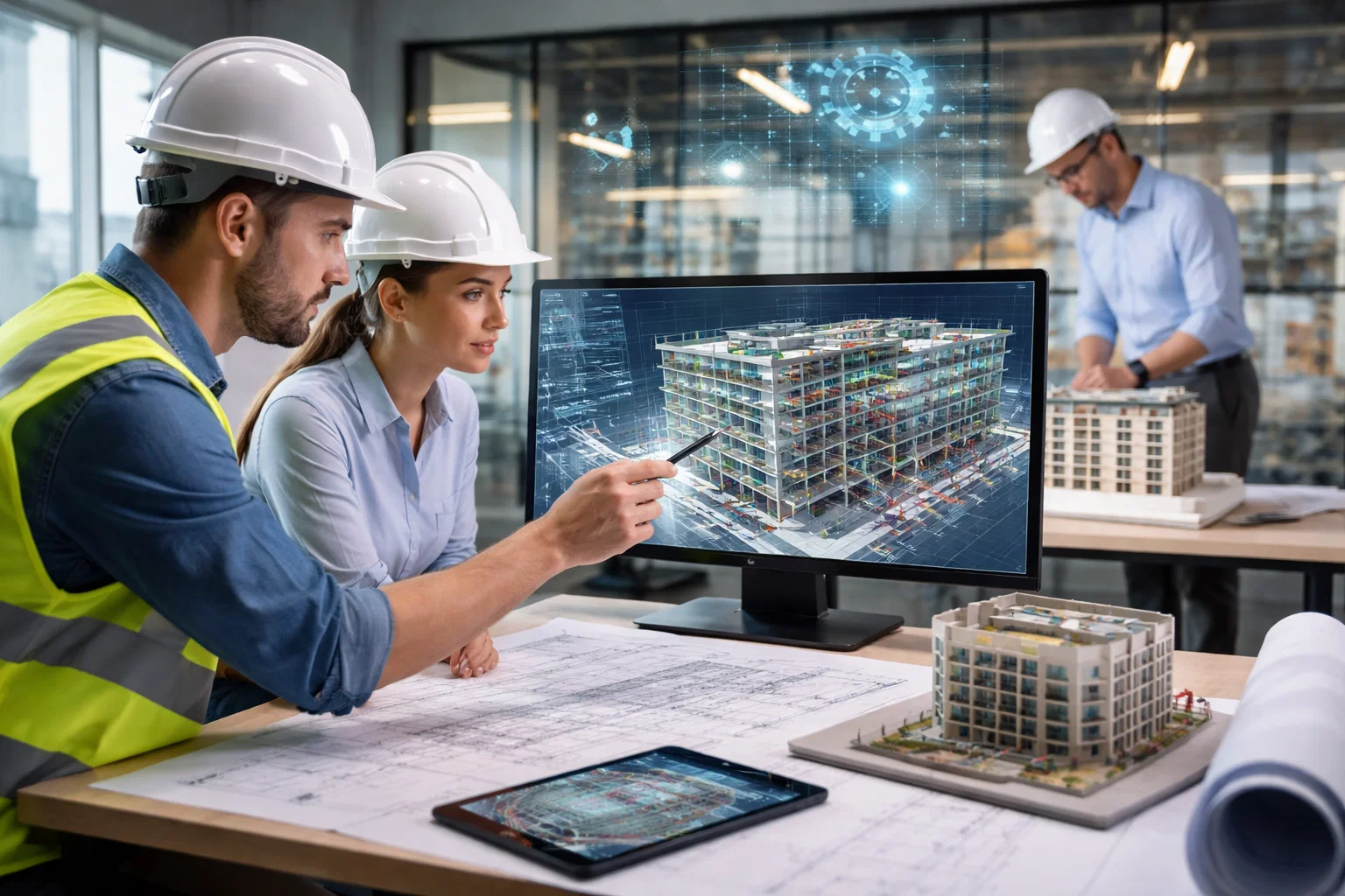
Laser scanning has quietly become one of those tools that saves a project from tiny mistakes that turn into expensive ones. A clean scan can settle arguments about what is actually on site, spot clashes before anyone starts cutting, and give designers something solid to work from instead of guesses and old drawings.
In the UK, laser scanning services cover everything from quick reality capture for refurb work to full as-built surveys and BIM-ready outputs. The difference between an okay result and a genuinely useful one usually comes down to process, not the scanner model. Good teams plan the scan properly, control registration, document accuracy, and deliver files that fit the workflow, whether that is point clouds, measured drawings, or coordinated models. When deadlines are tight and sites are messy, that practical side matters as much as the tech.
So, here is the curated list of laser scanning companies in the UK for point clouds, as-built surveys, and BIM-ready models, with a quick look at what each team offers.
1. باورخ

| الموقع الإلكتروني | www.powerkh.com |
| البريد الإلكتروني | [email protected] |
| فيسبوك | www.facebook.com/100064039650167 |
| لينكد إن | www.linkedin.com/company/powerkh |
| انستقرام | www.instagram.com/powerkh_com |
| العنوان | 3، لافينيا ووك، تاو هيل، سويندون SN25 1AP |
| الهاتف | +44 7490 426678 |
Powerkh works as an engineering-led digital construction consultancy that supports project teams from design through construction. We’re a UK-based company with offices in the United States and Ukraine, focused on applying Virtual Design and Construction principles to improve how complex builds are designed, coordinated, and executed. Our angle is design continuity – keeping key decisions intact during coordination, then using reality-based checks so the design does not quietly drift once work starts on site.
Laser scanning and existing-conditions modelling sit on the front end of our workflow, mainly to give teams a verified base before design moves too far. From there, our work shifts into coordination where risk usually lives – plant rooms, risers, and tight interfaces across structure and MEP – followed by technical review, model QA, and as-built verification so handover reflects what was actually built.
أبرز الملامح الرئيسية:
- Engineering-led support across design, coordination, and construction
- Existing-conditions capture and modelling for early-stage decision making
- Coordination focus on constrained zones and high-risk interfaces
- Technical reviews and model QA before construction issue
- Verification services linking design intent to site reality
الخدمات:
- Laser Scanning and Existing Conditions Modelling
- Structural and MEP Design Support
- Design Coordination and Critical Zone Resolution
- Technical Design and Constructability Review
- Design Continuity Support from Design to Construction
- Deviation Monitoring and Engineering Review
- Evidence-Based Progress Verification
- As-Built Verification and Handover Support
2. Laser Scanning Ltd

| الموقع الإلكتروني | www.laser-scanning.co.uk |
| البريد الإلكتروني | [email protected] |
| فيسبوك | www.facebook.com/laserscanninguk |
| لينكد إن | www.linkedin.com/company/laser-scanning-uk |
| انستقرام | www.instagram.com/laserscanninguk |
| العنوان | Unit 18, Chambers Way, Sheffield, S35 2PH |
| الهاتف | +44 (0) 114 551 5500 |
Laser Scanning Ltd specialise in non-contact 3D capture and measurement, with scanning delivered through on-site, mobile, and automated setups. The way they describe their work is very measurement-first – capturing accurate geometry quickly, without touching the part, and turning that into digital data that can be used in different technical contexts.
Most of their services sit downstream of the scan rather than stopping at a point cloud. Reverse engineering is a key piece, along with dimensional analysis and quality inspection where components are checked against design intent and requirements. They also support prototyping using processes like 3D printing, CNC machining, and laser cutting, which makes sense when the scan data needs to end up as a physical test part.
أبرز الملامح الرئيسية:
- Non-contact capture used to record detailed geometry
- On-site, mobile, and automated scanning setups
- Reverse engineering support for recreating parts and products
- Dimensional analysis and inspection for compliance checks
- Prototyping options using digital-to-physical workflows
الخدمات:
- المسح الضوئي بالليزر
- الهندسة العكسية
- Dimensional Analysis
- Quality Inspection
- النماذج الأولية
3. 3D Laser Scanning Services

| الموقع الإلكتروني | 3dlaserscanningservices.co.uk |
3D Laser Scanning Services provide site scanning for the built environment across the UK, aimed at architects, engineers, contractors, and property owners. Their focus is on capturing existing structures and environments as complete spatial datasets, so later planning and design is based on what is actually there rather than selective measurements or outdated drawings.
Their workflow follows the familiar scan-to-deliverable path. A point cloud is captured on site, then processed into the formats teams typically need – CAD drawings, as-built documentation, and BIM-compatible models when projects require Revit-ready outputs. Renovations and as-built records come up often, along with coordination uses like design validation and clash checking.
أبرز الملامح الرئيسية:
- Built-environment scanning aimed at design and construction teams
- Point cloud capture used to reduce uncertainty on real sites
- Outputs include drawings and BIM-compatible model deliverables
- Positioned for renovation, documentation, and coordination needs
- Supports validation and clash detection workflows
الخدمات:
- 3D Laser Scanning Surveys
- معالجة السحابة النقطية
- الوثائق كما هي مبنية
- رسومات CAD
- Revit and BIM-Compatible Models
- Digital Twin Support
4. Arthian

| الموقع الإلكتروني | www.arthian.com |
| البريد الإلكتروني | [email protected] |
| لينكد إن | www.linkedin.com/company/arthian |
| العنوان | 2 Tallis Street, London, EC4Y 0AB, England |
| الهاتف | +44 (0) 3301 200 151 |
Arthian delivers 3D laser scanning for industrial, infrastructure, and high-hazard sites across the UK. Their descriptions focus on practical constraints that shape this kind of work – reducing time on site, avoiding confined space entry, and capturing spaces that are difficult or unsafe to measure with conventional methods.
The output starts as dense point cloud data and then gets shaped into whatever the project needs next. They mention 2D drawings, 3D models, BIM datasets, and visualisations, with applications like dimensional control, plant layout, clash detection, structural and facade surveys, and geometry capture for process plant and tanks. Compliance and safety reporting also sits in the mix, which fits the environments they describe.
أبرز الملامح الرئيسية:
- Scanning services for industrial, infrastructure, and high-hazard settings
- Approach designed to reduce site time and improve safety
- Point clouds converted into drawings, models, and BIM datasets
- Supports plant layout, clash detection, and engineering documentation
- Includes compliance-focused applications for regulated sites
الخدمات:
- المسح الضوئي بالليزر ثلاثي الأبعاد
- Point Cloud Surveys
- Scan Data to 2D Drawings
- 3D Models and BIM-Ready Datasets
- As-Built Documentation and Dimensional Control
- Digital Twin Support
- Plant Layout and Clash Detection Support
- Compliance Support for Industrial Sites
5. SES Ltd
| الموقع الإلكتروني | www.sesltd.uk.com |
| البريد الإلكتروني | [email protected] |
| العنوان | 16 Tiller Court, Tiller Road, London, E14 8PX |
| الهاتف | (020) 7538 0870 |
SES Ltd introduced high definition surveying services to clients in 2004 and described laser scanning as a natural extension of standard surveying practice. Their page goes into practical survey detail – controlled setup over known points, careful orientation, and fast remote capture of exposed surfaces to create a dense point cloud that design teams can measure and rely on.
In addition, they spend time on how that data is used day to day. The point cloud can be shared early so teams can decide what needs to be drawn or modelled, instead of drafting everything by default. From the same dataset, deliverables can range from 2D plans, sections, and elevations to more complex 3D models and visualisations, including Revit BIM models where the expected level of detail is agreed before the survey. Facility management and record scanning is also covered, mostly as a way to revisit the building digitally without disrupting operations.
أبرز الملامح الرئيسية:
- Survey-led approach with controlled setup and standard procedures
- Dense point clouds used for extracting as-built information
- Wide range of civil, building, and engineering survey applications
- Deliverables from 2D drawings through to Revit BIM models
- Supports record and facility management use cases
الخدمات:
- Laser Scanning and Point Cloud Capture
- مسوحات المباني المقاسة
- As-Built Surveys
- Elevation and Facade Surveys
- المسوحات الطوبوغرافية
- Point Cloud to 2D Plans, Sections, and Elevations
- Point Cloud to 3D Models and Visualisations
- Revit BIM Models from Scan Data
- Facility Management Scan Records
6. Three Sixty Group
| الموقع الإلكتروني | 360hq.co.uk |
| البريد الإلكتروني | [email protected] |
| فيسبوك | www.facebook.com/ThreeSixtyGroupHQ |
| لينكد إن | www.linkedin.com/company/threesixtygrouphq |
| انستقرام | www.instagram.com/three_sixty_group |
| تويتر | x.com/ThreeSixty_HQ |
| العنوان | 360 Group, Unit G12, Clerkenwell Workshops, 27/31 Clerkenwell Close, London, EC1R 0AT |
| الهاتف | +44(0) 203 576 6025 |
Three Sixty Group offers 3D laser scanning as part of a broader 360 reality capture service, using non-contact scanning to capture millions of data points in a single visit. They frame scanning as a way to get surveys right the first time, so teams have enough context in the point cloud to reduce repeat site checks and avoid guesswork.
Their scanning outputs are positioned for use inside design software, with the point cloud forming the base for coordination and decision-making. Besides, they link scanning to related services like BIM modelling, drone surveying, and photogrammetry, and describe experience across a wide mix of sectors including construction, residential, utilities, rail, and public works.
أبرز الملامح الرئيسية:
- Laser scanning delivered within wider reality capture services
- One-visit site capture focused on reducing repeat surveys
- Point clouds set up for design software and coordination workflows
- Works alongside BIM modelling, drone surveying, and photogrammetry
- Covers a broad range of construction and infrastructure sectors
الخدمات:
- المسح الضوئي بالليزر ثلاثي الأبعاد
- Point Cloud Production and Delivery
- BIM Survey Support
- نمذجة ثلاثية الأبعاد BIM
- Drone Surveying
- التصوير الفوتوغرافي
- Reality Capture Services for Sites and Structures
7. مالتيفيستا
| الموقع الإلكتروني | www.multivista.com |
| البريد الإلكتروني | [email protected] |
| فيسبوك | www.facebook.com/Multivista |
| لينكد إن | www.linkedin.com/company/multivista |
| انستقرام | www.instagram.com/multivista |
| تويتر | كوم.كوم/ملتيفيستا |
| الهاتف | +44 2086 109 869 |
Multivista approaches laser scanning to BIM as a three-step workflow that starts with site capture and ends with a Revit model built from point cloud data. The way they frame it is simple – collect clean scans on site, then turn that reality capture into something a project team can use for planning, coordination, and as-built documentation.
Most of their detail sits in how the modelling is packaged and specified. They separate architectural and MEP modelling into clear scopes, with optional add-ons for things like facade detail, site features, or extra building elements. They also push a checklist-style way of briefing the job, so the Revit version, file formats, templates, and modelling expectations are clear before any processing starts.
أبرز الملامح الرئيسية:
- Scan-to-BIM workflow built around on-site capture and Revit modelling
- Modelling scopes split into architectural and MEP packages
- Optional add-ons to extend model scope beyond the base set
- Checklist-based briefing to lock down templates, versions, and outputs
- Online platform for viewing point clouds with basic collaboration tools
الخدمات:
- 3D Laser Scanning for point cloud capture
- معالجة السحابة النقطية
- Scan to BIM in Autodesk Revit
- Architectural Existing-Conditions Modelling
- MEP Existing-Conditions Modelling
- As-Built Model Deliverables
- Web and app-based point cloud viewing and markup
8. Manchester Metrology

| الموقع الإلكتروني | www.manchester-metrology.co.uk |
| البريد الإلكتروني | [email protected] |
| فيسبوك | www.facebook.com/manchestermetrology |
| لينكد إن | www.linkedin.com/company/manchester-metrology-limited |
| انستقرام | www.instagram.com/manchestermetrologyltd |
| تويتر | x.com/ManMetrologyLTD |
| العنوان | Manchester Metrology Ltd Unit 3, The Wellington Centre, Whitelands Road, Ashton-under-Lyne OL6 6UY |
| الهاتف | +44 (0) 161 637 8744 |
Manchester Metrology provides laser scanning and reverse engineering as part of a wider contract measurement offering. Their focus reads as metrology-first – non-contact scanning, controlled capture, and outputs that can be used for CAD comparison or inspection work when accuracy and repeatability matter.
Reverse engineering is described as a practical way to rebuild design intent from measured data, especially when parts need to be recreated without full documentation. They also put weight on reporting and file outputs, including true-to-form scan data and parametric CAD models, and they highlight the ability to scan in different locations using portable equipment.
أبرز الملامح الرئيسية:
- Contract measurement approach with laser scanning as a core method
- Non-contact scanning suited to varied environments using portable setups
- CAD comparison with reports tailored to the inspection need
- Reverse engineering workflows for recreating parts from measured data
- Outputs offered as mesh formats and parametric CAD models
الخدمات:
- المسح الضوئي بالليزر ثلاثي الأبعاد
- الهندسة العكسية
- CAD Comparison and Reporting
- Contract Measurement and Inspection Support
- 3D Data Output in mesh and CAD formats
9. Scantech International

| الموقع الإلكتروني | scantech-international.com |
| البريد الإلكتروني | [email protected] |
| العنوان | Hillside, Murrayfield, Prestbury SK10 4BZ |
| الهاتف | 01625 260446 |
Scantech International presents laser scanning as a full survey process, not just a quick capture step. They spend time explaining how scanning works, how scans are registered into a single point cloud, and how deliverables are then produced from that dataset for architecture, engineering, and other site-based use cases.
A big part of their content is about practical site technique – control, registration, and keeping accuracy consistent across the survey. They also talk through the real reasons teams use scanning on live sites, like reducing time in risky areas, working with minimal disruption in occupied buildings, and generating outputs that can feed into CAD and BIM tools for modelling, sections, elevations, or clash checking.
أبرز الملامح الرئيسية:
- Survey workflow explained from site scanning through registration to deliverables
- Emphasis on control and registration methods to support consistent accuracy
- Practical focus on safety, reduced site time, and limited disruption
- Deliverables shaped around point clouds, 2D outputs, and 3D modelling
- Works across building, infrastructure, and specialist survey scenarios
الخدمات:
- 3D Laser Scanning Surveys
- Registered Point Cloud Delivery
- مسوحات المباني المقاسة
- Sections and Elevations from point clouds
- 3D Modelling for as-built deliverables
- Topographical Surveys supported by scan data and other survey methods
- Clash Detection support using scan-based point clouds
- Volume and area measurement from scan datasets
10. SOCOTEC

| الموقع الإلكتروني | www.socotec.co.uk |
| فيسبوك | www.facebook.com/SocotecUK |
| لينكد إن | www.linkedin.com/company/socotecuk |
| انستقرام | www.instagram.com/socotec_uk |
| تويتر | x.com/SOCOTEC_UK |
| الهاتف | 01283 554400 |
SOCOTEC positions laser scanning within a broader inspection, testing, and survey context, with the service described as a way to collect large amounts of spatial information in congested or complicated environments. Their laser scanning page stays focused on outputs and project control – point clouds, photogrammetry, and 3D models that support planning and delivery when teams need a clear view of existing conditions.
The service description leans into standardisation and oversight. They mention structured quality control, project management, and a nationwide surveyor network, with deliverables supplied in different formats depending on how the data will be used in BIM tools or modelling workflows. The overall tone is consistent with a larger group offering services across the asset lifecycle, where laser scanning is one of several ways to produce usable, reviewable evidence.
أبرز الملامح الرئيسية:
- Laser scanning used for complex and congested environments
- Outputs include point clouds, photogrammetry, and 3D models
- Data supplied in formats suited to BIM and modelling workflows
- Quality control processes described as part of delivery
- Project management and broader survey network support
الخدمات:
- المسح الضوئي بالليزر
- Raw Point Cloud Deliverables
- التصوير الفوتوغرافي
- 3D Models including Revit outputs
- Mobile Mapping
- BIM-ready datasets for modelling and visualisation workflows
11. Digital Engineering Works Ltd

| الموقع الإلكتروني | deworks.uk |
| البريد الإلكتروني | [email protected] |
| لينكد إن | www.linkedin.com/company/deworks-uk |
| تويتر | x.com/d_e_works |
| العنوان | Building 3, Clock Tower Park, Liverpool. L10 1LD |
Digital Engineering Works Ltd describes laser scanning as part of a wider digital engineering setup that includes BIM, digital twins, and reality capture. Their writing ties scanning to what happens next – turning captured geometry into models, asset information, and coordinated project data that can be carried from design through to handover and into facility management.
A noticeable part of their focus is building services and live environments where access and disruption matter. They talk about scanning work in sensitive or operational settings, and they stress the practical side of delivery – supplying point clouds in compatible formats, or converting scan data into mesh outputs or BIM models. Beyond scanning, they place a lot of attention on ISO 19650-style information management, asset model authoring, and fabrication-oriented modelling workflows.
أبرز الملامح الرئيسية:
- Reality capture linked to BIM, digital twins, and asset information workflows
- Laser scanning positioned for building services and MEP coordination needs
- Experience described with scanning in operational and sensitive environments
- Output options include point clouds, scan to mesh, and scan to BIM
- Broader capability around ISO 19650 delivery and asset data authoring
الخدمات:
- Laser Scan Surveying
- Point Cloud Delivery in common formats
- Scan to Mesh conversion
- Scan to BIM and BIM authoring
- BIM and Asset Information Modelling support
- Asset data deliverables and model management
- DfMA modelling and fabrication-oriented outputs
- Digital engineering support from design stages through handover
12. ASES Ltd
| الموقع الإلكتروني | www.asesltd.com |
| البريد الإلكتروني | [email protected] |
| لينكد إن | www.linkedin.com/company/advanced-site-engineering-services |
| انستقرام | www.instagram.com/ases_ltd |
| تويتر | x.com/ASES_Ltd |
| العنوان | 1 Park Road, Hampton Wick, Kingston Upon Thames, Greater London, KT1 4AS |
| الهاتف | +44 (0)203 488 0148 |
ASES Ltd describe 3D laser scanning as high definition surveying with an emphasis on fast, remote capture and flexible outputs. Their page reads like a surveying team explaining how scan data becomes usable deliverables, with attention on practical constraints like access, level of detail, and the need to bring results into common CAD and modelling tools.
They also lean into the viewing and sharing side of scan data, mentioning panoramic measurement tools and a long list of export formats to fit different workflows. The deliverables they outline cover the usual range from 2D plans and elevations through to BIM models, meshes, and visual outputs like fly-throughs, which suits projects that need both technical documentation and clear communication of existing conditions.
أبرز الملامح الرئيسية:
- High definition surveying approach with remote capture and reduced site time
- Uses Leica scanning technology with integrated imagery for richer point clouds
- Suitable for challenging access situations and detailed survey requirements
- Wide export support for CAD and modelling workflows
- Deliverables range from 2D drawings to BIM, meshes, and visualisation outputs
الخدمات:
- المسح الضوئي بالليزر ثلاثي الأبعاد
- Point Cloud Deliverables in multiple formats
- 2D Plans, Sections, Elevations, and topographic outputs
- BIM and 3D model deliverables including Revit and DWG
- Mesh Models and rendered surfaces
- Coloured point clouds and visualisation outputs
- Panoramic point cloud measurement and coordinate viewing
13. 3Deling

| الموقع الإلكتروني | موقع 3deling.com |
| البريد الإلكتروني | [email protected] |
| لينكد إن | www.linkedin.com/company/3deling |
| فيسبوك | www.facebook.com/3Deling |
| العنوان | 3Deling Laser Scanning Services LTD, 6 Artichoke Mews, London, SE5 8TS, UK |
| الهاتف | +44 7739 036 829 |
3Deling work as a surveying company focused on 3D laser scanning and point cloud processing, with a lot of their day-to-day sitting around as-built surveys, clash detection, and turning scan data into usable project outputs. The scope they describe is broad – industrial sites, architecture and construction, heritage, offshore work, and large urban areas – but the common thread is the same: capture reliable spatial data, then build the deliverable that fits the way the client actually works.
A big part of their setup is what happens after capture. They process data in-house with a team of CAD engineers and lean heavily on Bentley tools alongside Revit and other scanning and registration software. Deliverables range from registered point clouds through 2D documentation and BIM-ready models to plant design databases like PDMS. Practical survey control comes up on larger sites, with targets, total station observations, and the option to leave a coordinate network in place for ongoing construction-phase work.
أبرز الملامح الرئيسية:
- Point cloud work across industrial, construction, heritage, offshore, and urban projects
- In-house processing team handling deliverables end to end
- Uses Bentley software heavily, alongside Revit and common scan toolchains
- Offers survey control and registration reporting on request
- Provides formats from CAD and BIM through to plant design model outputs
الخدمات:
- 3D Laser Scanning and Site Capture
- Point Cloud Registration and Processing
- Registered Point Cloud Delivery
- 2D CAD Documentation including plans, sections, and elevations
- 3D CAD Models in multiple formats
- BIM-ready models in Revit and other platforms
- Plant design models in PDMS and related systems
- Orthophotos and heritage documentation outputs
- Construction verification and clash detection analysis
- Deformation and movement monitoring
- Volume and topographical extraction from point clouds
- Panoramic imagery, TruViews, and virtual walkthrough outputs
14. Cadman Solutions

| الموقع الإلكتروني | cadmansolutions.co.uk |
| البريد الإلكتروني | [email protected] |
| لينكد إن | www.linkedin.com/in/david-worland-522ab522 |
| العنوان | 176A Wendover Rd, Weston Turville, Aylesbury, HP22 5TG |
| الهاتف | 01296 613122 |
Cadman Solutions run 3D scanning as a practical service for capturing the exact shape of physical parts, from small items through to larger panels and assemblies. Their content is clearly built around product and manufacturing use cases – capturing geometry without damaging the part, cleaning up mesh data, and using that scan as the starting point for CAD modelling, tooling work, or a 3D printing workflow.
A lot of their identity is tied to long-term CAD and reverse engineering experience, going back to the late 1980s. They describe the work as scanning plus the modelling discipline needed to recreate proper CAD, especially when drawings do not exist or when a part needs redesigning to actually be manufacturable. Their own mix of handheld scanners, CAD/CAM software, and 3D printing equipment is mentioned as part of that workflow, covering the jump from scan capture to model output and then into prototype production when needed.
أبرز الملامح الرئيسية:
- Non-contact 3D scanning for parts of different sizes
- Mesh handling with tools for tidying and improving scan data
- Reverse engineering aimed at recreating CAD when drawings are missing
- Long-running CAD modelling and data capture background
- Set up to support scan-to-print and prototype workflows
الخدمات:
- مسح ضوئي ثلاثي الأبعاد
- الهندسة العكسية
- CAD Modelling and Design support
- Mesh processing and format handling
- Data capture for 3D printing workflows
- Manufacturing support services
- 3D Printing and prototyping
15. Cadplan Services Ltd
| الموقع الإلكتروني | cadplan.co.uk |
| البريد الإلكتروني | [email protected] |
| لينكد إن | www.linkedin.com/company/cadplan-services-limited |
| الهاتف | 01732 469100 |
Cadplan Services Ltd sit firmly in the measured survey world, using laser scanning as one of the main ways they capture building and site information. Their page is written around typical property and construction needs – refurb work, listed buildings, new development planning, and as-built record creation – with scan data turned into drawings and models that can be used straight away by design and delivery teams.
There is a longer thread about adapting survey methods as technology has changed, and folding 3D scanning into most projects rather than treating it as a specialist add-on. Their outputs are the standard set you would expect from a measured survey practice: floor plans, elevations, sections, point clouds, and Revit models for BIM use. Adjacent survey services are referenced as well – topographic work, underground utilities, rights of light, and aerial survey – which places laser scanning inside a wider measurement offering rather than as a standalone product.
أبرز الملامح الرئيسية:
- Measured survey practice using laser scanning for building and site capture
- Outputs include CAD drawings and BIM-ready Revit models
- Set up for refurb, heritage, and development planning scenarios
- Laser scanning used alongside other survey disciplines when needed
- Focus on clear, practical deliverables for design and planning work
الخدمات:
- المسح الضوئي بالليزر ثلاثي الأبعاد
- مسوحات المباني المقاسة
- 3D Revit Models and BIM outputs
- CAD Drawings including plans, sections, and elevations
- المسوحات الطوبوغرافية
- Underground Utility Surveys
- Rights of Light Surveys
- Aerial survey and inspection
- Lease plans and Land Registry plans
16. Apex Engineering Services Ltd

| الموقع الإلكتروني | apex.uk.net |
| البريد الإلكتروني | [email protected] |
| فيسبوك | www.facebook.com/APEX.Eng.Services |
| لينكد إن | www.linkedin.com/company/aes_2 |
| انستقرام | www.instagram.com/apex.engineering.services |
| العنوان | F7 Expressway, 1 Dock Road, London, E16 1AH |
| الهاتف | +44 207018 1635 |
Apex Engineering Services Ltd describe laser scanning as one part of a wider construction-focused surveying and technical services offering. Their service write-up is built around producing high-definition 3D representations of spaces and structures, with point clouds and models that can be used for planning, design decisions, and verification once construction starts.
Leica TruView Enterprise is presented as a useful by-product of scanning, giving teams a browser-based way to view, annotate, and share reality data without specialist software. The scan outputs are framed as something that stays useful through the project lifecycle – checking progress, spotting potential conflicts, and verifying outcomes against intended conditions. A wider list of engineering and survey services sits around scanning, so the laser work fits into a broader site and delivery toolkit.
أبرز الملامح الرئيسية:
- Laser scanning offered within a wider construction surveying and technical service set
- Produces point clouds and 3D models in CAD-compatible formats
- TruView Enterprise access for browser-based viewing and collaboration
- Outputs positioned for planning, coordination, and verification tasks
- Scanning sits alongside other survey and site engineering services
الخدمات:
- المسح الضوئي بالليزر
- Point Cloud and 3D Model Deliverables
- CAD-compatible scan outputs for project workflows
- TruView Enterprise data viewing and collaboration
- Construction progress and verification support using scan data
- Survey and site engineering services alongside scanning
17. Stellar Engineering

| الموقع الإلكتروني | www.stellar-engineering.co.uk |
| البريد الإلكتروني | [email protected] |
| لينكد إن | www.linkedin.com/company/stellar-engineeringsolutions |
| العنوان | Stellar Engineering, 10 Merchant Court, Monkton Business Park South, Hebburn, NE31 2EX |
| الهاتف | +44 (0)1914 064536 |
Stellar Engineering describes laser surveying and scanning as a practical tool for projects where existing infrastructure makes the work harder, not easier. Their focus is brownfield and repair order environments, with scanning used to capture reliable data in confined, complex, or hazardous spaces while keeping disruption low.
The scan data is described as an input into analysis and engineering decisions, rather than an end product. From there, the work flows into fabrication and installation drawings that translate survey outputs into construction documents. Offshore and onshore surveying are part of the wider offering, which fits the environments and constraints they highlight.
أبرز الملامح الرئيسية:
- Laser scanning positioned for brownfield and repair order projects
- Designed for complex, confined, or hazardous environments with minimal disruption
- Scan data used as an input to precision engineering analysis
- Produces fabrication and installation drawings from survey outputs
- Supports both offshore and onshore surveying work
الخدمات:
- Laser Surveying and Scanning
- 3D Building and Infrastructure Laser Scanning
- Survey and scan data analysis for engineering use
- Offshore and onshore surveying
- إنتاج الرسم التصنيعي
- Installation drawing production
الخاتمة
Laser scanning in the UK is not one single service that every provider delivers in the same way. Some teams are set up for buildings and refurbishment surveys, others live in industrial and offshore environments, and a few sit closer to metrology or equipment support than site surveying. The important part is matching the company to the job, not the other way around.
A good choice usually comes down to what needs to be produced from the scan, not the scan itself. Point cloud only, CAD drawings, Revit models, plant databases, clash checks, mesh outputs, heritage documentation – each one needs a slightly different workflow and a different level of checking. It is worth being clear on scope, formats, and level of detail up front, because that is where most misunderstandings start.
The list in this article is meant to make that first step easier. It shows a spread of UK options, from survey-led scanning to scan-to-model delivery and specialist engineering use cases, so it is simpler to find a team that fits the work instead of forcing the work to fit the team.

هل لديك مشروع BIM؟ تحدث إلينا.
اتصل بنادراسات الحالة لدينا
لقد تعاملنا مع أكثر من 200 مشروع من مشاريع نمذجة معلومات المباني ونمذجة معلومات المباني للقطاعات التجارية والصناعية والسكنية.
يشمل عملنا ما يلي:
أتمتة تصميم القوالب
Our client from
California, USA
أتمتة تصميم السقف المعلق
Our client from
New York, USA
أتمتة تصميم إطارات الحائط
Our client from
California, USA